| National Center for Education Statistics |
| College Navigator |
| Generated at:12/14/2015 5:32:51 AM from URL:http://nces.ed.gov/collegenavigator/default.aspx?s=IL&l=91+93&xp=1 |
| Name |
Address |
| Alvareitas College of Cosmetology-Belleville |
5400 West Main, Belleville, Illinois 62226 |
| Alvareitas College of Cosmetology-Edwardsville |
333 South Kansas St, Edwardsville, Illinois 62025 |
| Alvareitas College of Cosmetology-Godfrey |
3048 Godfrey Rd, Godfrey, Illinois 62035-4150 |
| Ambria College of Nursing |
5210 Trillium Blvd, Hoffman Estates, Illinois 60192 |
| American Academy of Art |
332 S Michigan Ave, Chicago, Illinois 60604-4302 |
| American InterContinental University-Online |
231 N. Martingale Rd., 6th Floor, Schaumburg, Illinois 60173 |
| Argosy University-Chicago |
225 N. Michigan Ave, Ste 1300, Chicago, Illinois 60601 |
| Argosy University-Schaumburg |
999 North Plaza Dr., Suite 111, Schaumburg, Illinois 60173-5403 |
| Augustana College |
639 38th St, Rock Island, Illinois 61201-2296 |
| Aurora University |
347 S Gladstone Ave, Aurora, Illinois 60506-4892 |
| Aveda Institute-Chicago |
2828 N Clark St, Chicago, Illinois 60657 |
| Bell Mar Beauty College |
5717 W. Cermak Road, Cicero, Illinois 60804 |
| Benedictine University |
5700 College Rd, Lisle, Illinois 60532-0900 |
| BIR Training Center |
3601 W Devon Avenue, Ste. 310, Chicago, Illinois 60659 |
| Black Hawk College |
6600-34th Avenue, Moline, Illinois 61265-5899 |
| Blackburn College |
700 College Ave, Carlinville, Illinois 62626 |
| Blessing Hospital School of Medical Laboratory Technology |
Broadway at 11th St, Quincy, Illinois 62305-7005 |
| Blessing Hospital School of Radiologic Technology |
Broadway at 14th, Quincy, Illinois 62305-7005 |
| Blessing Rieman College of Nursing |
Broadway at 11th Street, Quincy, Illinois 62305-7005 |
| Bradley University |
1501 W BRADLEY AVE, Peoria, Illinois 61625-0001 |
| Cains Barber College Inc |
365 E 51st St, Chicago, Illinois 60615-3510 |
| CALC Institute of Technology |
200A North Center Dr, Alton, Illinois 62002 |
| Cameo Beauty Academy |
9714 S Cicero Ave., Oak Lawn, Illinois 60453 |
| Cannella School of Hair Design-Blue Island |
12943 S Western Ave, Blue Island, Illinois 60406-2130 |
| Cannella School of Hair Design-Chicago |
4269 S Archer Ave, Chicago, Illinois 60632-2549 |
| Cannella School of Hair Design-Chicago |
9012 S Commercial, Chicago, Illinois 60617-4303 |
| Cannella School of Hair Design-Chicago |
4217 W North Ave, Chicago, Illinois 60639-4828 |
| Cannella School of Hair Design-Elgin |
117 W Chicago St, Elgin, Illinois 60120 |
| Cannella School of Hair Design-Villa Park |
617 W. NORTH, Villa Park, Illinois 60181 |
| Capital Area School of Practical Nursing |
2201 Toronto Rd, Springfield, Illinois 62712-3803 |
| Capri Beauty College |
15815 S Rob Roy Dr, Oak Forest, Illinois 60452 |
| Capri Beauty College |
1938 E Lincoln Hwy, New Lenox, Illinois 60451 |
| Career Center of Southern Illinois |
6137 Beck Rd, Red Bud, Illinois 62278 |
| Carl Sandburg College |
2400 Tom L. Wilson Boulevard, Galesburg, Illinois 61401 |
| CET-Chicago |
100 N Western, 3rd Floor, Chicago, Illinois 60612 |
| Chamberlain College of Nursing-Illinois |
1221 N Swift Rd, Addison, Illinois 60101 |
| Chicago ORT Technical Institute |
5440 Fargo Avenue, Skokie, Illinois 60077 |
| Chicago State University |
9501 S. King Drive, Chicago, Illinois 60628-1598 |
| Christian Life College |
400 E Gregory St, Mount Prospect, Illinois 60056-2522 |
| City Colleges of Chicago-Harold Washington College |
30 E Lake St, Chicago, Illinois 60601-2449 |
| City Colleges of Chicago-Harry S Truman College |
1145 W Wilson Ave., Chicago, Illinois 60640-6063 |
| City Colleges of Chicago-Kennedy-King College |
6301 S Halsted St, Chicago, Illinois 60621-2709 |
| City Colleges of Chicago-Malcolm X College |
1900 W Van Buren, Chicago, Illinois 60612-3197 |
| City Colleges of Chicago-Olive-Harvey College |
10001 S Woodlawn Ave, Chicago, Illinois 60628-1696 |
| City Colleges of Chicago-Richard J Daley College |
7500 S Pulaski Rd, Chicago, Illinois 60652-1299 |
| City Colleges of Chicago-Wilbur Wright College |
4300 N Narragansett, Chicago, Illinois 60634-1500 |
| College of DuPage |
425 Fawell Blvd., Glen Ellyn, Illinois 60137-6599 |
| College of Lake County |
19351 W Washington St., Grayslake, Illinois 60030-1198 |
| Columbia College-Chicago |
600 South Michigan, Chicago, Illinois 60605-1996 |
| Computer Systems Institute |
8930 Gross Point Rd, Skokie, Illinois 60077 |
| Concept College of Cosmetology |
2500 Georgetown Rd, Danville, Illinois 61832 |
| Concept College of Cosmetology |
202 East University Street, suite H, I,& J, Urbana, Illinois 61801 |
| Concordia University-Chicago |
7400 Augusta, River Forest, Illinois 60305-1499 |
| Cortiva Institute-Chicago |
17 N. State Street, Suite 500, Chicago, Illinois 60602 |
| Cosmetology & Spa Academy |
700 E. Terra Cotta, Crystal Lake, Illinois 60014 |
| Coyne College |
330 North Green Street, Chicago, Illinois 60607-1300 |
| Creative Touch Cosmetology School |
234 East 3rd Street, Waterloo, Illinois 62298-1609 |
| Curve Metric School of Hair Design |
7645 West Belmont Avenue, Elmwood Park, Illinois 60707-1118 |
| Danville Area Community College |
2000 E Main St, Danville, Illinois 61832-5118 |
| Debutantes School of Cosmetology and Nail Technology |
145 N. 3rd Street, Dekalb, Illinois 60115-3301 |
| DePaul University |
1 E Jackson Blvd, Chicago, Illinois 60604 |
| DeVry University-Illinois |
3300 N Campbell Ave, Chicago, Illinois 60618 |
| Dominican University |
7900 W Division Street, River Forest, Illinois 60305 |
| Eastern Illinois University |
600 Lincoln Avenue, Charleston, Illinois 61920 |
| East-West University |
816 S Michigan Ave, Chicago, Illinois 60605 |
| Educators of Beauty College of Cosmetology-La Salle |
122 Wright St, La Salle, Illinois 61301 |
| Educators of Beauty College of Cosmetology-Rockford |
2601 N. Mulford, Rockford, Illinois 61114 |
| Educators of Beauty College of Cosmetology-Sterling |
211 E Third St, Sterling, Illinois 61081-3611 |
| Elgin Community College |
1700 Spartan Drive, Elgin, Illinois 60123-7193 |
| Elmhurst College |
190 Prospect Ave, Elmhurst, Illinois 60126-3096 |
| Empire Beauty School-Arlington Heights |
264 West Rand Rd, Arlington Heights, Illinois 60004 |
| Empire Beauty School-Hanover Park |
1166 East Lake St, Hanover Park, Illinois 60133-5421 |
| Empire Beauty School-Lisle |
2709 Maple Avenue, Lisle, Illinois 60532 |
| Empire Beauty School-Stone Park |
3106 West North Avenue, Stone Park, Illinois 60165-1010 |
| Empire Beauty School-Vernon Hills |
226 Hawthorn Village Commons, Vernon Hills, Illinois 60061-1519 |
| Estelle Skin Care and Spa Institute |
10024 Skokie Blvd, 301, Skokie, Illinois 60077-9945 |
| ETI School of Skilled Trades |
500 Joliet Road, Suite100, Willowbrook, Illinois 60527 |
| Eureka College |
300 E. College Avenue, Eureka, Illinois 61530 |
| European Massage Therapy School-Skokie |
4905 Old Orchard Center, suite 710, Skokie, Illinois 60077 |
| Everest College-Bedford Park |
7414 South Cicero Avenue, Bedford Park, Illinois 60629-5819 |
| Everest College-Burr Ridge |
6880 N Frontage Rd. Suite 400, Burr Ridge, Illinois 60527 |
| Everest College-Melrose Park |
1101 West North Avenue, Suite 1, Melrose Park, Illinois 60160-1526 |
| Everest College-Merrionette Park |
11560 S. Kedzie, Merrionette Park, Illinois 60803 |
| Everest College-North Aurora |
150 S Lincolnway 100, North Aurora, Illinois 60542 |
| Everest College-Skokie |
9811 Woods Drive, Skokie, Illinois 60077-1074 |
| First Institute Inc |
790 McHenry Ave, Crystal Lake, Illinois 60014 |
| Fox College |
6640 S. Cicero, Bedford Park, Illinois 60638 |
| Frontier Community College |
Frontier Drive, Fairfield, Illinois 62837 |
| G Skin & Beauty Institute |
1200 Harger Road, Oakbrook, Illinois 60523 |
| Gem City College |
700 State St, Quincy, Illinois 62301 |
| Governors State University |
1 University Pky, University Park, Illinois 60484 |
| Graham Hospital School of Nursing |
210 W Walnut St, Canton, Illinois 61520-2497 |
| Greenville College |
315 E. College Ave, Greenville, Illinois 62246 |
| Hair Professionals Academy of Cosmetology |
825 B6 Village Quarter Road, West Dundee, Illinois 60118 |
| Hair Professionals Career College |
10321 S Roberts Rd, Palos Hills, Illinois 60465 |
| Hair Professionals Career College |
2245 Gateway Drive, Sycamore, Illinois 60178 |
| Hair Professionals School of Cosmetology |
5460 U.S. Highway 34, Oswego, Illinois 60543 |
| Hairmasters Institute of Cosmetology |
506 S McClun St, Bloomington, Illinois 61701 |
| Harrington College of Design |
200 W. Madison, Chicago, Illinois 60606 |
| Heartland Community College |
1500 West Raab Road, Normal, Illinois 61761-9446 |
| Hebrew Theological College |
7135 N Carpenter Rd, Skokie, Illinois 60077 |
| Highland Community College |
2998 W Pearl City Rd, Freeport, Illinois 61032-9341 |
| HSHS St. Johns Hospital School of Clinical Laboratory Science |
800 E Carpenter St., Springfield, Illinois 62769 |
| Illinois Center for Broadcasting |
455 Eisenhower Lane South Suite 200, Lombard, Illinois 60148 |
| Illinois Center for Broadcasting–Chicago Campus |
530 S. State St., Chicago, Illinois 60605 |
| Illinois Central College |
1 College Drive, East Peoria, Illinois 61635-0001 |
| Illinois College |
1101 W College Ave, Jacksonville, Illinois 62650-2299 |
| Illinois Institute of Technology |
3300 S Federal St, Chicago, Illinois 60616 |
| Illinois School of Health Careers-Chicago Campus |
11 East Adams St. Ste 200, Chicago, Illinois 60603 |
| Illinois School of Health Careers-OHare Campus |
11 East Adams Street-Ste 200, Chicago, Illinois 60603 |
| Illinois State University |
North and School Streets, Normal, Illinois 61790-1000 |
| Illinois Valley Community College |
815 N Orlando Smith Ave, Oglesby, Illinois 61348-9692 |
| Illinois Wesleyan University |
1312 N Park St, Bloomington, Illinois 61702-2900 |
| Innovations Design Academy |
125 E Locust St, Canton, Illinois 61520 |
| ITT Technical Institute-Arlington Heights |
3800 N. Wilke Road, Suite 100, Arlington Heights, Illinois 60004 |
| ITT Technical Institute-Oak Brook |
800 Jorie Boulevard, Suite 100, Oak Brook, Illinois 60523 |
| ITT Technical Institute-Orland Park |
11551 184th Place, Orland Park, Illinois 60467 |
| ITT Technical Institute-Springfield |
2501 Wabash Avenue, Springfield, Illinois 62704-5373 |
| J Renee College |
415 Airport Road, Elgin, Illinois 60123 |
| John A Logan College |
700 Logan College Road, Carterville, Illinois 62918-2500 |
| John Amico School of Hair Design |
15301 South Cicero Avenue, Oak Forest, Illinois 60452-2501 |
| John Wood Community College |
1301 S 48th Street, Quincy, Illinois 62305-8736 |
| Joliet Junior College |
1215 Houbolt Rd, Joliet, Illinois 60431-8938 |
| Judson University |
1151 N State St, Elgin, Illinois 60123-1498 |
| Kankakee Community College |
100 College Drive, Kankakee, Illinois 60901 |
| Kaskaskia College |
27210 College Rd, Centralia, Illinois 62801 |
| Kendall College |
900 N. North Branch St., Chicago, Illinois 60642 |
| Kishwaukee College |
21193 Malta Rd, Malta, Illinois 60150-9699 |
| Knox College |
2 E South St, Galesburg, Illinois 61401-9999 |
| La James International College-East Moline |
485 Avenue of the Cities, East Moline, Illinois 61244 |
| Lake Forest College |
555 N Sheridan Road, Lake Forest, Illinois 60045-2399 |
| Lake Land College |
5001 Lake Land Blvd, Mattoon, Illinois 61938 |
| Lakeview College of Nursing |
903 N Logan Ave, Danville, Illinois 61832 |
| Larrys Barber College |
10456 S. Halsted Street, Chicago, Illinois 60628-2322 |
| Le Cordon Bleu College of Culinary Arts-Chicago |
361 W Chestnut, Chicago, Illinois 60610 |
| Lewis and Clark Community College |
5800 Godfrey Rd, Godfrey, Illinois 62035 |
| Lewis University |
One University Parkway, Romeoville, Illinois 60446-2200 |
| Lincoln Christian University |
100 Campus View Drive, Lincoln, Illinois 62656-2111 |
| Lincoln College |
300 Keokuk St, Lincoln, Illinois 62656 |
| Lincoln College of Technology-Melrose Park |
8317 W North Avenue, Melrose Park, Illinois 60160-1605 |
| Lincoln Land Community College |
5250 Shepherd Rd, Springfield, Illinois 62794-9256 |
| Lincoln Trail College |
11220 State Hwy 1, Robinson, Illinois 62454 |
| Loyola University Chicago |
1032 W. Sheridan Rd, Chicago, Illinois 60660 |
| MacMurray College |
447 East College Ave, Jacksonville, Illinois 62650-2590 |
| Madison Media Institute-Rockford Career College |
1130 South Alpine Road, Rockford, Illinois 61108 |
| McHenry County College |
8900 US Hwy 14, Crystal Lake, Illinois 60012-2761 |
| McKendree University |
701 College Rd, Lebanon, Illinois 62254-1291 |
| Methodist College |
415 St. Mark Court, Peoria, Illinois 61603 |
| Midstate College |
411 W Northmoor Road, Peoria, Illinois 61614-3595 |
| Midwest Technical Institute-East Peoria |
280 High Point Ln, East Peoria, Illinois 61611 |
| Midwest Technical Institute-Moline |
3620 Avenue of the Cities, Moline, Illinois 61265-4421 |
| Midwest Technical Institute-Springfield |
2731 Farmers Market Road, Springfield, Illinois 62707 |
| Midwestern Career College |
20 North Wacker Drive Ste 3800, Chicago, Illinois 60606 |
| Millikin University |
1184 W Main St, Decatur, Illinois 62522-2084 |
| Monmouth College |
700 E Broadway, Monmouth, Illinois 61462-1998 |
| Moody Bible Institute |
820 N LaSalle Blvd, Chicago, Illinois 60610-3284 |
| Moraine Valley Community College |
9000 W. College Parkway, Palos Hills, Illinois 60465-0937 |
| Morthland College |
202 East Oak Street, West Frankfort, Illinois 62896-2742 |
| Morton College |
3801 S Central Ave, Cicero, Illinois 60804-4398 |
| Mr Johns School of Cosmetology & Nails-Jacksonville |
1429 S Main St, Jacksonville, Illinois 62650 |
| Mr Johns School of Cosmetology Esthetics & Nails-Decatur |
1745 E Eldorado St., Decatur, Illinois 62521 |
| National Latino Education Institute |
2011 W Pershing Rd, Chicago, Illinois 60609-2205 |
| National Louis University |
122 S Michigan Ave, Chicago, Illinois 60603 |
| National University of Health Sciences |
200 E Roosevelt Rd, Lombard, Illinois 60148-4583 |
| Networks Barber College |
508 Burnham Ave, Calumet City, Illinois 60409 |
| Niles School of Cosmetology |
8057 N. Milwaukee Avenue, Niles, Illinois 60714 |
| North Central College |
30 N Brainard St, Naperville, Illinois 60540 |
| North Park University |
3225 W Foster Ave, Chicago, Illinois 60625-4895 |
| Northeastern Illinois University |
5500 N Saint Louis Ave, Chicago, Illinois 60625-4699 |
| Northern Illinois University |
1425 W. Lincoln Hwy., Dekalb, Illinois 60115-2828 |
| Northwestern College-Chicago Campus |
4829 North Lipps Avenue, Chicago, Illinois 60630 |
| Northwestern College-Southwestern Campus |
7725 South Harlem Avenue, Bridgeview, Illinois 60455 |
| Northwestern University |
633 Clark St, Evanston, Illinois 60208 |
| Oakton Community College |
1600 E Golf Rd., Des Plaines, Illinois 60016-1268 |
| Oehrlein School of Cosmetology |
100 Meadow Ave, East Peoria, Illinois 61611 |
| Olivet Nazarene University |
One University Avenue, Bourbonnais, Illinois 60914-2271 |
| Olney Central College |
305 N West Street, Olney, Illinois 62450 |
| Pacific College of Oriental Medicine-Chicago |
65 East Wacker Place, 21st fl, Chicago, Illinois 60601 |
| Parkland College |
2400 W Bradley Ave, Champaign, Illinois 61821-1899 |
| Paul Mitchell the School-Bradley |
1600 N. State Rt. 50 Room 522, Bourbonnais, Illinois 60914 |
| Paul Mitchell the School-Chicago |
1225 S Halsted St, Chicago, Illinois 60607 |
| Paul Mitchell the School-Lombard |
106 Yorktown Center, Lombard, Illinois 60148 |
| Paul Mitchell the School-Normal |
1503 E College Ave Ste L, Normal, Illinois 61761 |
| PCCTI IT and Healthcare |
2625 Butterfield Road, Ste 102E, Oak Brook, Illinois 60523-1234 |
| Pivot Point Academy-Bloomingdale |
144C East Lake Street, Bloomingdale, Illinois 60108-0000 |
| Pivot Point Academy-Chicago |
3901 West Irving Park, Chicago, Illinois 60618 |
| Pivot Point Academy-Evanston |
1560 Sherman Avenue – Annex, Evanston, Illinois 60201 |
| Prairie State College |
202 South Halsted Street, Chicago Heights, Illinois 60411-8226 |
| Prince Institute-Great Lakes |
1300 E. Woodfield Road, Ste 110, Schaumburg, Illinois 60173-4908 |
| Prince Institute-Southeast |
1300 E Woodfield Rd, Suite 110, Schaumburg, Illinois 60173 |
| Principia College |
1 Maybeck Place, Elsah, Illinois 62028-9799 |
| Professionals Choice Hair Design Academy |
2719 W Jefferson St, Joliet, Illinois 60435 |
| Quincy University |
1800 College Ave, Quincy, Illinois 62301-2699 |
| Rasmussen College-Illinois |
6000 East State Street, 4th Floor, Rockford, Illinois 61108-2513 |
| Regency Beauty Institute-Aurora |
4374 East New York Street, Aurora, Illinois 60504 |


 Bakhmut and Alchevsk raions (district) in Luhansk, Ukraine on vector map. Every settlement, village and town can be found on its map. Orientation is assisted by a scalbar.


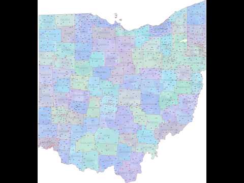
 Ohio state – shape


 5 digit editable zip code map of Louisiana


