
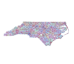
NC state zip code county road map. The file shows the geographic location of postal code numbers on precisely edited overlapping layers. The network of semi-transparent counties and main roads show an important element of marketing planning.

Zip codes under the same primary name are marked with the same color

Raleigh: 27601, 27603, 27604, 27605, 27606
Charlotte: 28202, 28203, 28204, 28205, 28206
Durham: 27701, 27703, 27704, 27705, 27707
Greensboro: 27401, 27403, 27405, 27406, 27407
Winston-Salem: 27101, 27103, 27104, 27105, 27106
Asheville: 28801, 28803, 28804, 28805, 28806
Wilmington: 28401, 28403, 28405, 28409, 28411
Chapel Hill: 27514, 27516, 27517
Fayetteville: 28301, 28303, 28304, 28305, 28306
In the United States, zip codes are used to route and sort mail, and they also have various applications beyond mail delivery. Here are the types of zip codes:
Standard ZIP Codes:
These are the most common type of zip codes and are used for general mail delivery. They represent specific geographic regions, such as towns, cities, or neighborhoods. The vector map shows only these zip codes.
Unique ZIP Codes:
Some organizations or entities receive unique zip codes due to their large volume of mail or specific needs. For example, government agencies, universities, or large corporations might have their own unique zip codes.
PO Box ZIP Codes:
These codes are specifically assigned to post office boxes within a post office. They are often used by individuals or businesses that do not have street addresses or prefer the added privacy of a PO Box.
Military ZIP Codes (APO/FPO/DPO):
These codes are used for addressing military mail. APO (Army Post Office), FPO (Fleet Post Office), and DPO (Diplomatic Post Office) codes are used to route mail to U.S. military and diplomatic installations around the world.
Other North Carolina map
North Carolina Mercator projection county map, North Carolina county map, county seats. North Carolina state zip code kml files North Carolina county map, colored. Counties and municipalities of North Carolina state NC road map
The NC state zip code county road map file in vector format enable the user organise level of structuring of map.
A vector file (ai, pdf) has flexible tools for displaying elements of maps
- you can discrete or arbitrary scaling map
- performing group operation with selected features
- changing the orders of displaying layers
- switching in/off displaying os any layers
- changing attributes of selected object ( recolour, modify outline thick, transparency, symbols)
- adding or changing features of any items, (i.e. font type)
- copying and moving particular shapes
- merging different shapes (i.e. counties)
- adding, removing cartography symbols
For editing ai, pdf file use the most common Adobe Illustrator (version 10 or higher) or CorelDRAW (version 10 or higher). If you don't have Adobe Illustrator or Corel you can choose
free open source Inkscape - 57 MB -(Windows, Mac, Linux platform ) or Scribus (Windows, Mac, Linux (54 MB)