
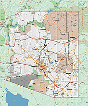
Arizona vector county map with background image. 19 MB
The large jpg file allows you to see what part of the state each county occupies. The wallpaper is of medium quality, we don’t expect a wonderful print from it, but it is suitable for projection and presentation. Use it for a projector, for teaching, or for a presentation.
Arizona cities by population
Jpg image 2560 x 3072 px, 72 ppi

Other Arizona maps
3 digit
KML files
County
Universitas
Zip codes
8 states
Scottsdale
Arizona-desert
The Arizona vector county map with background image. 19 MB file in vector format enable the user organise level of structuring of map.
A vector file (ai, pdf) has flexible tools for displaying elements of maps
- you can discrete or arbitrary scaling map
- performing group operation with selected features
- changing the orders of displaying layers
- switching in/off displaying os any layers
- changing attributes of selected object ( recolour, modify outline thick, transparency, symbols)
- adding or changing features of any items, (i.e. font type)
- copying and moving particular shapes
- merging different shapes (i.e. counties)
- adding, removing cartography symbols
For editing ai, pdf file use the most common Adobe Illustrator (version 10 or higher) or CorelDRAW (version 10 or higher). If you don't have Adobe Illustrator or Corel you can choose
free open source Inkscape - 57 MB -(Windows, Mac, Linux platform ) or Scribus (Windows, Mac, Linux (54 MB)