
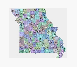
Postal code of Missouri state with name of location
Take an official U.S. census file, color out the zip code fields, write the names of the cities in a different color if you can, pour them down with a map of the counties, see them by their names, and set the transparency to 50% if you can. And you’re ready to use the all-inclusive Missouri State 5-digit zip code file.
If possible, pay first and then download.😄

The Preview of Missouri zip code vector map file in vector format enable the user organise level of structuring of map.
A vector file (ai, pdf) has flexible tools for displaying elements of maps
- you can discrete or arbitrary scaling map
- performing group operation with selected features
- changing the orders of displaying layers
- switching in/off displaying os any layers
- changing attributes of selected object ( recolour, modify outline thick, transparency, symbols)
- adding or changing features of any items, (i.e. font type)
- copying and moving particular shapes
- merging different shapes (i.e. counties)
- adding, removing cartography symbols
For editing ai, pdf file use the most common Adobe Illustrator (version 10 or higher) or CorelDRAW (version 10 or higher). If you don't have Adobe Illustrator or Corel you can choose
free open source Inkscape - 57 MB -(Windows, Mac, Linux platform ) or Scribus (Windows, Mac, Linux (54 MB)