
JPG background image size 2304×2816 px at 72 ppi.
County map of Utah state.16 MB.
The file contains a background image.
The contours and filling of the counties are vector. Counties of Utah:
| Box Elder | Cache | Weber | Morgan | Summit | Davis | Tooele | Daggett | Salt Lake | Uintah | Duchesne |
| Wasatch | Utah | Juab | Carbon | Sanpete | Emery | Millard | Grand | |||
| Sevier | Beaver | Piute | Wayne | San Juan | Garfield | Iron | Washington | Kane |
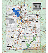
Other Utah map
Utah state zip code kml files County seats and FIPS codes AI map of AZ NM CO UT states
Background is a raster pic. Screen resolution.

The County map of Utah state.16 MB. file in vector format enable the user organise level of structuring of map.
A vector file (ai, pdf) has flexible tools for displaying elements of maps
- you can discrete or arbitrary scaling map
- performing group operation with selected features
- changing the orders of displaying layers
- switching in/off displaying os any layers
- changing attributes of selected object ( recolour, modify outline thick, transparency, symbols)
- adding or changing features of any items, (i.e. font type)
- copying and moving particular shapes
- merging different shapes (i.e. counties)
- adding, removing cartography symbols
For editing ai, pdf file use the most common Adobe Illustrator (version 10 or higher) or CorelDRAW (version 10 or higher). If you don't have Adobe Illustrator or Corel you can choose
free open source Inkscape - 57 MB -(Windows, Mac, Linux platform ) or Scribus (Windows, Mac, Linux (54 MB)