
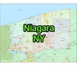
US-NY-Niagara-county-map vector map. Adobe Illustrator file. File size: 1,9 MB. Cities, rivers, roads, lakes
etc. Data source: U.S. Geological Survey
Location:
- Region: Western New York
- Adjacent Counties: Niagara County is bordered by Lake Ontario to the north, Erie County to the south, Genesee County to the east, and the province of Ontario, Canada, to the northwest.
- Distance from NYC: Niagara County is approximately 370 miles northwest of New York City.
Geography of US-NY-Niagara-county-map
- Land Area: Niagara County covers an area of 1,140 square miles.
- Terrain: The county’s terrain is relatively flat near Lake Ontario, with some rolling hills and fertile farmland further inland.
- Waterways: In addition to Lake Ontario, the Niagara River forms the western boundary of the county, including the famous Niagara Falls.
- Transport:Roads: Major highways include Interstate 90 (the New York State Thruway), Interstate 190, and Route 31.

The US-NY-Niagara-county-map file in vector format enable the user organise level of structuring of map.
A vector file (ai, pdf) has flexible tools for displaying elements of maps
- you can discrete or arbitrary scaling map
- performing group operation with selected features
- changing the orders of displaying layers
- switching in/off displaying os any layers
- changing attributes of selected object ( recolour, modify outline thick, transparency, symbols)
- adding or changing features of any items, (i.e. font type)
- copying and moving particular shapes
- merging different shapes (i.e. counties)
- adding, removing cartography symbols
For editing ai, pdf file use the most common Adobe Illustrator (version 10 or higher) or CorelDRAW (version 10 or higher). If you don't have Adobe Illustrator or Corel you can choose
free open source Inkscape - 57 MB -(Windows, Mac, Linux platform ) or Scribus (Windows, Mac, Linux (54 MB)