
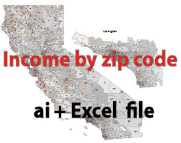
California zip codes map with income an editable, detailed file with well-defined layers. 19.8 MB All standard zip code shapes are included.
All standard zip code shapes are included. The excel file is a bit outdated, but it shows the trends well. The source of the California zip codes map with income file is the US Census Bureau
Illustrator (cs5) and Excel file with latest data -December 2017.
-Household average – or mean – income by zip code
-Household median income by zip code
-Income per capita by zip code
-CA population by zip code
-Zip code in counties
-Zip code Primary cities
In Illustrator file
Zip code shapes with number and location name.
Layers and file content


The California zip codes map with income file in vector format enable the user organise level of structuring of map.
A vector file (ai, pdf) has flexible tools for displaying elements of maps
- you can discrete or arbitrary scaling map
- performing group operation with selected features
- changing the orders of displaying layers
- switching in/off displaying os any layers
- changing attributes of selected object ( recolour, modify outline thick, transparency, symbols)
- adding or changing features of any items, (i.e. font type)
- copying and moving particular shapes
- merging different shapes (i.e. counties)
- adding, removing cartography symbols
For editing ai, pdf file use the most common Adobe Illustrator (version 10 or higher) or CorelDRAW (version 10 or higher). If you don't have Adobe Illustrator or Corel you can choose
free open source Inkscape - 57 MB -(Windows, Mac, Linux platform ) or Scribus (Windows, Mac, Linux (54 MB)