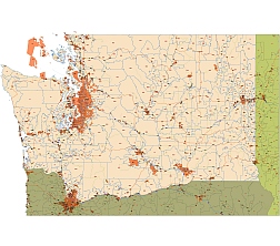
Highways, urban areas map of Washington state on Washington state zip code map
Adobe Illustrator CS5 version 13 MB
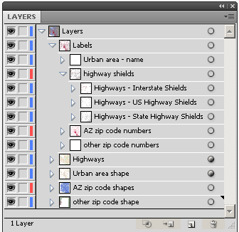
Layers
– Urban area – name
– Highway shields
– Highways- Interstate Shields
– Highways – US Highway Shields
– Highways – State Highway Shields
– Targeted STATE ZIP CODE NUMBERS
– Other zip code numbers
– Highways – lines
– Urban area – shapes
– Targeted STATE ZIP CODE SHAPES
– other zip code – shapes
Zip codes and primary city
98418 Tacoma 98421 Tacoma 98422 Tacoma 98424 Tacoma 98430 Camp Murray 98433 Tacoma 98438 Mcchord Afb 98439 Lakewood 98443 Tacoma 98444 Tacoma 98445 Tacoma 98446 Tacoma 98447 Tacoma 98465 Tacoma 98466 Tacoma 98467 University Place 98498 Lakewood 98499 Lakewood 98501 Olympia 98502 Olympia 98503 Lacey 98506 Olympia 98512 Olympia 98513 Olympia 98516 Olympia 98520 Aberdeen 98524 Allyn 98526 Amanda Park 98527 Bay Center 98528 Belfair 98530 Bucoda 98531 Centralia 98532 Chehalis 98533 Cinebar 98535 Copalis Beach 98536 Copalis Crossing 98310 Bremerton 98311 Bremerton 98312 Bremerton 98314 Bremerton 98315 Silverdale 98320 Brinnon 98321 Buckley 98323 Carbonado 98325 Chimacum 98326 Clallam Bay 98327 Dupont 98328 Eatonville 98329 Gig Harbor 98330 Elbe 98331 Forks 98332 Gig Harbor 98333 Fox Island 98335 Gig Harbor 98336 Glenoma 98337 Bremerton 98338 Graham 98339 Port Hadlock 98340 Hansville 98342 Indianola 98345 Keyport 98346 Kingston 98349 Lakebay 98350 La Push 98351 Longbranch 98353 Manchester 98354 Milton 98355 Mineral 98356 Morton 98357 Neah Bay 98358 Nordland 98359 Olalla 98360 Orting 98361 Packwood 98362 Port Angeles 98363 Port Angeles 98364 Port Gamble 98365 Port Ludlow 98366 Port Orchard 98367 Port Orchard 98368 Port Townsend and more 521 zip code area.
Highway numbers on map
Interstate I-5, Interstate I-90, Interstate I-182.

Other WA map
The Washington state zip code map file in vector format enable the user organise level of structuring of map.
A vector file (ai, pdf) has flexible tools for displaying elements of maps
- you can discrete or arbitrary scaling map
- performing group operation with selected features
- changing the orders of displaying layers
- switching in/off displaying os any layers
- changing attributes of selected object ( recolour, modify outline thick, transparency, symbols)
- adding or changing features of any items, (i.e. font type)
- copying and moving particular shapes
- merging different shapes (i.e. counties)
- adding, removing cartography symbols
For editing ai, pdf file use the most common Adobe Illustrator (version 10 or higher) or CorelDRAW (version 10 or higher). If you don't have Adobe Illustrator or Corel you can choose
free open source Inkscape - 57 MB -(Windows, Mac, Linux platform ) or Scribus (Windows, Mac, Linux (54 MB)

