
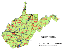
A map of West Virginia includes interstates, US Highways and State routes
West Virginia vector road map
Layers structure of WV map
- capital sign of state West Virginia
- names of rivers, lakes of state West Virginia
- country name white of state West Virginia
- county name black of state West Virginia
- highway symbols of state West Virginia
- road singns state West Virginia
- city names of state West Virginia
- highway – lines of state West Virginia
- A road lines of state West Virginia
- B road lines of state West Virginia
- C road lines of state West Virginia
- lakes of state West Virginia
- rivers of state West Virginia
- urban areas of state West Virginia
- state border os state West Virginia
- counties of state West Virginia
Jpg file: 4252 x 3425 px. at 300 dpi 4.95 MB

Ohter West Virginia maps: County map, Zip code map
 |
Counties:
Barbour Berkeley Boone Braxton Brooke Cabell Calhoun Clay Doddridge Fayette Gilm Grant Greenbrier Hampshire Hancock Hardy Harrison Jackson Jefferson Kanawha Lewis Lincoln Logan Marion Marshall Mason Mcdowell Mercer Mineral Mingo Monongalia Monroe Morgan Nicholas Ohio Pendleton Pleasants Pocahontas Preston Putnam Raleigh Randolph Ritchie Roane Summers Taylor Tucker Tyler Upshur Wayne Webster Wetzel Wirt Wood Wyoming
Cities of WV:
Belington, WV
Belle, WV
Belmont, WV
Benwood, WV
Bethany, WV
Beverly, WV
Bluefield, WV
Bradley, WV
Bradshaw, WV
Bramwell, WV
Bridgeport, WV
Buckhannon, WV
Buffalo, WV
Burnsville, WV
Cairo, WV
Cameron, WV
Cassville, WV
Cedar Grove, WV
Ceredo, WV
Chapmanville, WV
Charles Town, WV
Charleston, WV
Chattaroy, WV
Chester, WV
Clarksburg, WV
Clay, WV
Clendenin, WV
Coal City, WV
Cowen, WV
Crab Orchard, WV
Craigsville, WV
Culloden, WV
Daniels, WV
Danville, WV
Davis, WV
Davy, WV
Delbarton, WV
The West Virginia vector road map. file in vector format enable the user organise level of structuring of map.
A vector file (ai, pdf) has flexible tools for displaying elements of maps
- you can discrete or arbitrary scaling map
- performing group operation with selected features
- changing the orders of displaying layers
- switching in/off displaying os any layers
- changing attributes of selected object ( recolour, modify outline thick, transparency, symbols)
- adding or changing features of any items, (i.e. font type)
- copying and moving particular shapes
- merging different shapes (i.e. counties)
- adding, removing cartography symbols
For editing ai, pdf file use the most common Adobe Illustrator (version 10 or higher) or CorelDRAW (version 10 or higher). If you don't have Adobe Illustrator or Corel you can choose
free open source Inkscape - 57 MB -(Windows, Mac, Linux platform ) or Scribus (Windows, Mac, Linux (54 MB)