
US-NY-Orange-county-map vector map. Adobe Illustrator file. 4,2 MB. Cities, rivers, roads, lakes
etc. Data source: U.S. Geological Survey
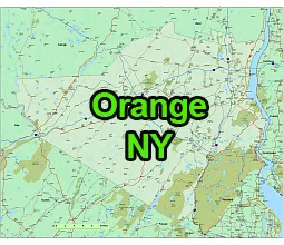
Location:
- Region: Hudson Valley
- Adjacent Counties: Orange County is bordered by Sullivan County to the north, Ulster County to the northwest, Dutchess County to the northeast, Putnam County to the east, Rockland County to the south, and across the Hudson River lies Westchester County.
- Distance from NYC: Orange County is located about 50 miles north of New York City.
Geography:
- Land Area: Orange County covers an area of 839 square miles.
- Terrain: The county’s terrain varies from rolling hills in the north to flatlands in the south. The Hudson River forms the eastern border of the county.
- Waterways: Besides the Hudson River, the county is also home to the Wallkill River and several reservoirs.
The US-NY-Orange-county-map file in vector format enable the user organise level of structuring of map.
A vector file (ai, pdf) has flexible tools for displaying elements of maps
- you can discrete or arbitrary scaling map
- performing group operation with selected features
- changing the orders of displaying layers
- switching in/off displaying os any layers
- changing attributes of selected object ( recolour, modify outline thick, transparency, symbols)
- adding or changing features of any items, (i.e. font type)
- copying and moving particular shapes
- merging different shapes (i.e. counties)
- adding, removing cartography symbols
For editing ai, pdf file use the most common Adobe Illustrator (version 10 or higher) or CorelDRAW (version 10 or higher). If you don't have Adobe Illustrator or Corel you can choose
free open source Inkscape - 57 MB -(Windows, Mac, Linux platform ) or Scribus (Windows, Mac, Linux (54 MB)