
US-NY-Columbia-county-map Adober Illustrator file, CS5 version
About Columbia county
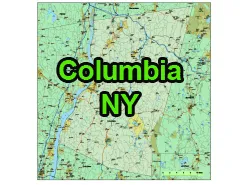
Columbia County is located in the eastern part of the state of New York, USA. Here is an overview of information about Columbia County:
Geography:
- Location: Columbia County is situated in the Hudson Valley region of New York.
- Bordering Counties: It is bordered by Rensselaer County to the north, Berkshire County in Massachusetts to the east, Dutchess County to the south, and Greene County to the west.
- Size: The county has a total area of 648 square miles (1,680 km2), making it one of the smaller counties in New York by land area.
County Seat and Largest City:
- County Seat: Hudson
- Largest City: Hudson
Attractions and Culture:
- Hudson River: The county is named after the Hudson River, which runs along its western border. The river provides opportunities for boating, fishing, and scenic views.
- Olana State Historic Site: The former home and studio of Hudson River School painter Frederic Edwin Church is located in Columbia County. It is now a historic site and museum.
- Hudson: The city of Hudson is known for its well-preserved historic architecture, art galleries, antique shops, and restaurants.
- Chatham: A town known for its walkable downtown area, farms, and the Crandell Theatre, which shows independent films.
- Clermont State Historic Site: The former estate of the prominent Livingston family, offering tours of the historic mansion and gardens.
- Taconic State Park: A state park offering hiking, camping, and outdoor recreation along the Taconic Mountain Range.

The US-NY-Columbia-county-map file in vector format enable the user organise level of structuring of map.
A vector file (ai, pdf) has flexible tools for displaying elements of maps
- you can discrete or arbitrary scaling map
- performing group operation with selected features
- changing the orders of displaying layers
- switching in/off displaying os any layers
- changing attributes of selected object ( recolour, modify outline thick, transparency, symbols)
- adding or changing features of any items, (i.e. font type)
- copying and moving particular shapes
- merging different shapes (i.e. counties)
- adding, removing cartography symbols
For editing ai, pdf file use the most common Adobe Illustrator (version 10 or higher) or CorelDRAW (version 10 or higher). If you don't have Adobe Illustrator or Corel you can choose
free open source Inkscape - 57 MB -(Windows, Mac, Linux platform ) or Scribus (Windows, Mac, Linux (54 MB)