
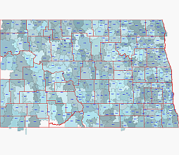
North Dakota zip codes map towns, counties
| in map Adams County, ND |
| in map Barnes County, ND |
| in map Benson County, ND |
| in map Billings County, ND |
| in map Bottineau County, ND |
| in map Bowman County, ND |
| in map Burke County, ND |
| in map Burleigh County, ND |
| in map Cass County, ND |
| in map Cavalier County, ND |
| in map Dickey County, ND |
| in map Divide County, ND |
| in map Dunn County, ND |
| in map Eddy County, ND |
| in map Emmons County, ND |
| in map Foster County, ND |
| in map Golden Valley County, ND |
| in map Grand Forks County, ND |
| in map Grant County, ND |
| in map Griggs County, ND |
| in map Hettinger County, ND |
| in map Kidder County, ND |
| in map LaMoure County, ND |
| in map Logan County, ND |
| in map McHenry County, ND |
| in map McIntosh County, ND |
| in map McKenzie County, ND |
| in map McLean County, ND |
| in map Mercer County, ND |
| in map Morton County, ND |
| in map Mountrail County, ND |
| in map Nelson County, ND |
| in map Oliver County, ND |
| in map Pembina County, ND |
| in map Pierce County, ND |
| in map Ramsey County, ND |
| in map Ransom County, ND |
| in map Renville County, ND |
| in map Richland County, ND |
| in map Rolette County, ND |
| in map Sargent County, ND |
| in map Sheridan County, ND |
| in map Sioux County, ND |
| in map Slope County, ND |
| in map Stark County, ND |
| in map Steele County, ND |
| in map Stutsman County, ND |
| in map Towner County, ND |
| in map Traill County, ND |
| in map Walsh County, ND |
| in map Ward County, ND |
| in map Wells County, ND |
| in map Williams County, ND |
The North Dakota zip codes map, towns, counties file in vector format enable the user organise level of structuring of map.
A vector file (ai, pdf) has flexible tools for displaying elements of maps
- you can discrete or arbitrary scaling map
- performing group operation with selected features
- changing the orders of displaying layers
- switching in/off displaying os any layers
- changing attributes of selected object ( recolour, modify outline thick, transparency, symbols)
- adding or changing features of any items, (i.e. font type)
- copying and moving particular shapes
- merging different shapes (i.e. counties)
- adding, removing cartography symbols
For editing ai, pdf file use the most common Adobe Illustrator (version 10 or higher) or CorelDRAW (version 10 or higher). If you don't have Adobe Illustrator or Corel you can choose
free open source Inkscape - 57 MB -(Windows, Mac, Linux platform ) or Scribus (Windows, Mac, Linux (54 MB)