
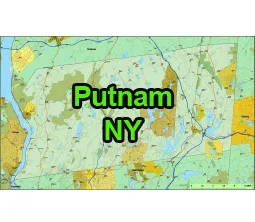
US-NY-Putnam-county-map vector map. Adobe Illustrator file. File size: 1,6 MB. Cities, rivers, roads, lakes
etc. Data source: U.S. Geological Survey
Location:
- Region: Hudson Valley
- Adjacent Counties:
- Dutchess County (to the north)
- Westchester County (to the south)
- Rockland County (to the southwest)
- Fairfield County, Connecticut (across the state border to the east)
County Seat:
The county seat is Carmel.
Geography:
- Land Area: Approximately 230 square miles.
- Topography: Putnam County is characterized by rolling hills, forests, and numerous lakes, giving it a scenic and natural landscape.
- Hudson River: The eastern border of Putnam County is formed by a section of the Hudson River.

The US-NY-Putnam-county-map file in vector format enable the user organise level of structuring of map.
A vector file (ai, pdf) has flexible tools for displaying elements of maps
- you can discrete or arbitrary scaling map
- performing group operation with selected features
- changing the orders of displaying layers
- switching in/off displaying os any layers
- changing attributes of selected object ( recolour, modify outline thick, transparency, symbols)
- adding or changing features of any items, (i.e. font type)
- copying and moving particular shapes
- merging different shapes (i.e. counties)
- adding, removing cartography symbols
For editing ai, pdf file use the most common Adobe Illustrator (version 10 or higher) or CorelDRAW (version 10 or higher). If you don't have Adobe Illustrator or Corel you can choose
free open source Inkscape - 57 MB -(Windows, Mac, Linux platform ) or Scribus (Windows, Mac, Linux (54 MB)