
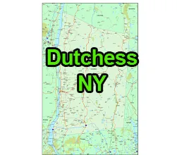
US-NY-Dutchess-county-map vector map. Adobe Illustrator file. File size: 2.7 MB. Cities, rivers, roads, lakes
etc. Data source: U.S. Geological Survey
Location:
- Region: Mid-Hudson Valley
- Adjacent Counties: Dutchess County is located to the south of Columbia County, east of Ulster County, west of Litchfield County in Connecticut, and north of Putnam County.
- Distance from NYC: Dutchess County is about 70 to 90 miles north of New York City, making it part of the New York Metropolitan Area.
Geography:
- Land Area: Dutchess County covers an area of 825 square miles.
- Terrain: The county features diverse geography, including the Hudson River to the west and the Taconic Mountains to the east.
- Parks and Nature: It is known for its scenic beauty, with parks like the Hudson Highlands State Park, James Baird State Park, and the Appalachian Trail passing through parts of the county.
The US-NY-Dutchess-county-map file in vector format enable the user organise level of structuring of map.
A vector file (ai, pdf) has flexible tools for displaying elements of maps
- you can discrete or arbitrary scaling map
- performing group operation with selected features
- changing the orders of displaying layers
- switching in/off displaying os any layers
- changing attributes of selected object ( recolour, modify outline thick, transparency, symbols)
- adding or changing features of any items, (i.e. font type)
- copying and moving particular shapes
- merging different shapes (i.e. counties)
- adding, removing cartography symbols
For editing ai, pdf file use the most common Adobe Illustrator (version 10 or higher) or CorelDRAW (version 10 or higher). If you don't have Adobe Illustrator or Corel you can choose
free open source Inkscape - 57 MB -(Windows, Mac, Linux platform ) or Scribus (Windows, Mac, Linux (54 MB)