
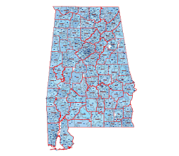
Alabama simple zip code map
Table of Contents

Information
Alabama zip code is a range from 35004 to 36925. Includes 841 zip codes. Alabama is a state located in the southeastern region of the United States.
What type are zip codes ?
Standard ZIP Codes: These are the most common ZIP codes used for general mail delivery to residential and commercial areas. Alabama has 597 standard Zip codes
PO Box ZIP Codes: These ZIP codes are specifically designated for P.O. Box addresses at post offices. Since P.O. Boxes are often located within post office facilities, they have unique ZIP codes to distinguish them from standard street addresses. Alabama has 177 PO BOX zip codes
Unique ZIP Codes: A ZIP Code assigned to a company, government agency Alabama has 65 Unique zip codes
Military ZIP Codes: These ZIP codes are used for military installations, including bases, posts, camps, and ships.
Are all zip codes on Alabama map?
No. Only Standard types.
Can I download the Alabama zip code list as an Excel file?
Yes, it is free. The latest list includes all zip code types.
It contains the following columns: Zip code number, Zip code typ, Primary city, State name, County name, Time zone , Area Codes, Estimated population. Download:
Alabama simple zip code map
| zip code | typ | primary city | state | county | time zone | area codes | estimated population |
| 35004 | STANDARD | Moody | AL | St. Clair County | America/Chicago | 205, 659 | 10400 |
| 35005 | STANDARD | Adamsville | AL | Jefferson County | America/Chicago | 205, 659 | 6210 |
| 35006 | STANDARD | Adger | AL | Jefferson County | America/Chicago | 205, 659 | 2500 |
| 35007 | STANDARD | Alabaster | AL | Shelby County | America/Chicago | 205, 659 | 25270 |
| 35010 | STANDARD | Alexander City | AL | Tallapoosa County | America/Chicago | 256, 334, 938 | 15690 |
| 35011 | PO BOX | Alexander City | AL | Tallapoosa County | America/Chicago | 256 | 1496 |
| 35013 | PO BOX | Allgood | AL | Blount County | America/Chicago | 205, 659 | 422 |
| 35014 | STANDARD | Alpine | AL | Talladega County | America/Chicago | 205, 256, 659, 938 | 3110 |
| 35015 | PO BOX | Alton | AL | Jefferson County | America/Chicago | 205 | 35 |
| 35016 | STANDARD | Arab | AL | Marshall County | America/Chicago | 256, 938 | 15200 |
| 35019 | STANDARD | Baileyton | AL | Cullman County | America/Chicago | 256, 938 | 2030 |
| 35020 | STANDARD | Bessemer | AL | Jefferson County | America/Chicago | 205, 659 | 17240 |
| 35021 | PO BOX | Bessemer | AL | Jefferson County | America/Chicago | 205 | 684 |
| 35022 | STANDARD | Bessemer | AL | Jefferson County | America/Chicago | 205, 659 | 19570 |
| 35023 | STANDARD | Bessemer | AL | Jefferson County | America/Chicago | 205, 659 | 19970 |
| 35031 | STANDARD | Blountsville | AL | Blount County | America/Chicago | 205, 256, 659, 938 | 6530 |
| 35032 | PO BOX | Bon Air | AL | Talladega County | America/Chicago | 256, 938 | 130 |
| 35033 | STANDARD | Bremen | AL | Cullman County | America/Chicago | 205, 256, 659, 938 | 3100 |
| 35034 | STANDARD | Brent | AL | Bibb County | America/Chicago | 205, 334, 659 | 2940 |
| 35035 | STANDARD | Brierfield | AL | Bibb County | America/Chicago | 205, 334, 659 | 1160 |
More Alabama maps


https://www.zipdatamaps.com/county/alabama/tallapoosa-county-profile-and-map
The Alabama simple zip code map file in vector format enable the user organise level of structuring of map.
A vector file (ai, pdf) has flexible tools for displaying elements of maps
- you can discrete or arbitrary scaling map
- performing group operation with selected features
- changing the orders of displaying layers
- switching in/off displaying os any layers
- changing attributes of selected object ( recolour, modify outline thick, transparency, symbols)
- adding or changing features of any items, (i.e. font type)
- copying and moving particular shapes
- merging different shapes (i.e. counties)
- adding, removing cartography symbols
For editing ai, pdf file use the most common Adobe Illustrator (version 10 or higher) or CorelDRAW (version 10 or higher). If you don't have Adobe Illustrator or Corel you can choose
free open source Inkscape - 57 MB -(Windows, Mac, Linux platform ) or Scribus (Windows, Mac, Linux (54 MB)