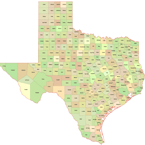
Texas Colored County Map
Texas Colored County Map A high-quality, fully editable vector map of Texas, AI, and Layered PDF file. Instant download.
Price range: 10,00 $ through 12,00 $
Select optionsThis product has multiple variants. The options may be chosen on the product page
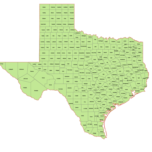
Texas Vector County Map
Texas Vector County Map is a professionally designed Illustrator artwork. The map supports infinite magnification.
Price range: 8,00 $ through 10,00 $
Select optionsThis product has multiple variants. The options may be chosen on the product page
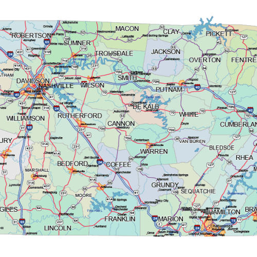
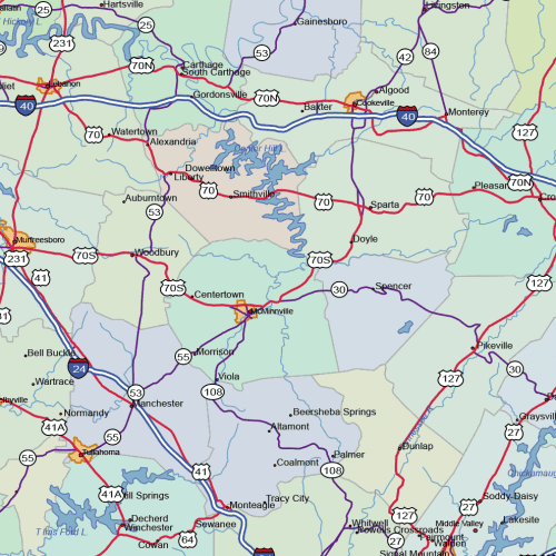
Tennessee Road and City Map
The Tennessee Road and City Map displays a wide range of features, including major roads, cities, and larger settlements. Rivers, lakes. AI, PDF.
Price range: 39,90 $ through 45,00 $
Select optionsThis product has multiple variants. The options may be chosen on the product page
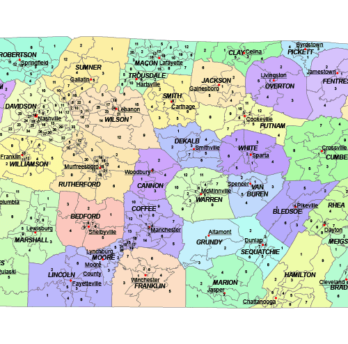
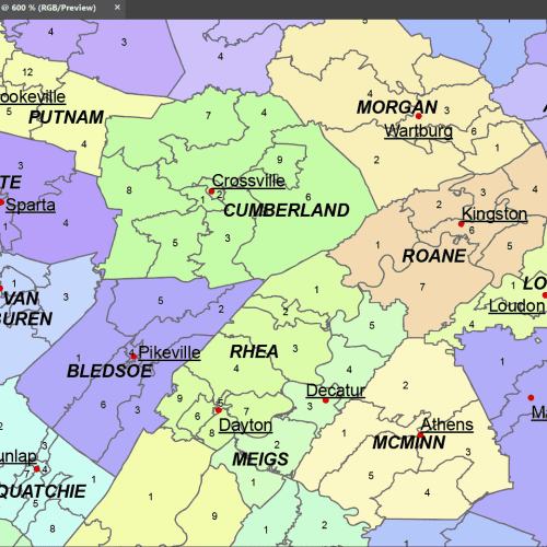
Tennessee Communities Map – Detailed Sub-County Vector File
The Tennessee Communities Map. This vector map highlights communities, cities, and districts across the state. Instant download. Ideal for research & design.
Price range: 17,90 $ through 19,90 $
Select optionsThis product has multiple variants. The options may be chosen on the product page
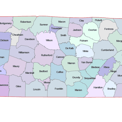
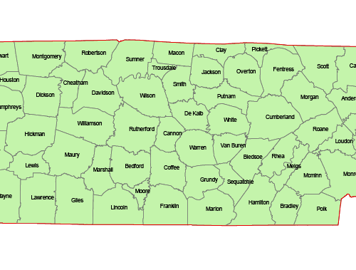
Tennessee Colored County Map
Tennessee Colored County Map A high-quality, fully editable vector map of Tennessee .AI and Layered PDF file. Instant download.
Price range: 10,00 $ through 12,00 $
Select optionsThis product has multiple variants. The options may be chosen on the product page
Tennessee Vector County Map
The Tennessee Vector County Map is a professionally designed Illustrator artwork. The map supports infinite magnification.
Price range: 8,00 $ through 10,00 $
Select optionsThis product has multiple variants. The options may be chosen on the product page
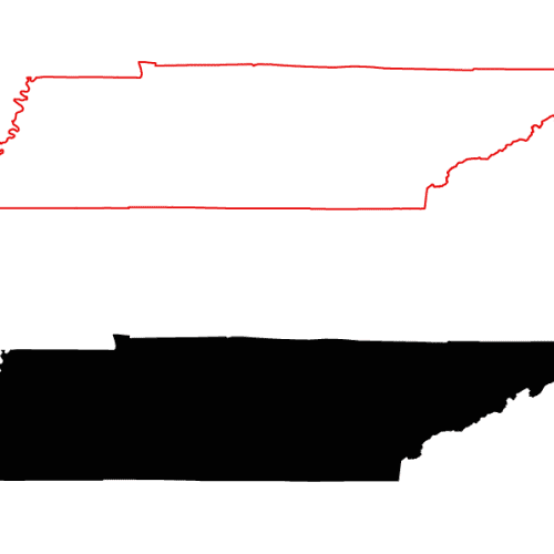
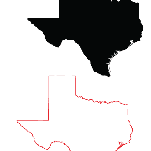
Tennessee Free Black Filled Map
Tennessee Free Black Filled Map Download Illustrator Tennessee Free Map.ai Download PDF Tennessee PDF file
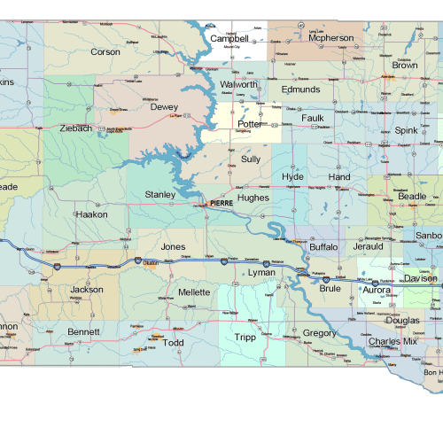
South Dakota Road and City Map
The South Dakota Road and City Map displays a wide range of features, including major roads, larger settlements. It also includes rivers and lakes. AI, PDF.
Price range: 41,90 $ through 45,00 $
Select optionsThis product has multiple variants. The options may be chosen on the product page