Preview of Idaho State vector road map.ai, pdf, 300 dpi jpg

Your-Vector-Maps.com Preview of Idaho State vector road map.ai, pdf, 300 dpi jpg

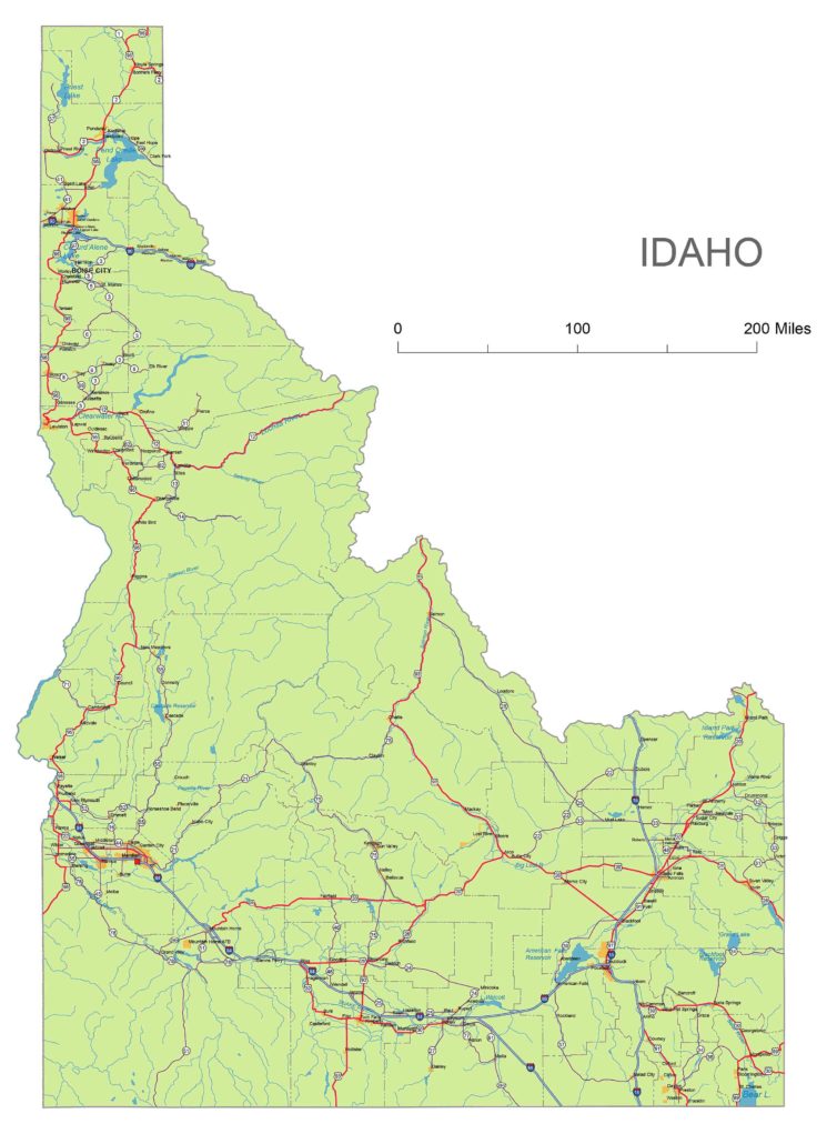
Idaho State National and State Higways map

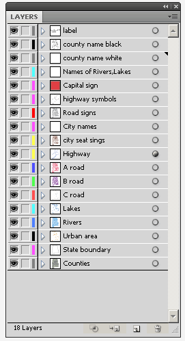
California vector map-layers Layers
-county name black of state Idaho
-country name white of state Idaho
-names of rivers, lakes of state Idaho
-capital sign of state Idaho
-highway symbols of state Idaho
-road signs state Idaho
-city names of state Idaho
-highway – lines of state Idaho
-A road lines of state Idaho
-B road lines of state Idaho
-C road lines of state Idaho
-lakes of state Idaho
-rivers of state Idaho
-urban areas of state Idaho
-state border os state Idaho
-counties of state  Idaho
Counties:
Ada, Adams, Bannock, Bear Lake, Benewah, Bingham, Blaine, Boise, Bonner, Bonneville, Boundary, Butte, Camas, Canyon, Caribou, Cassia, Clark, Clearwater, Custer, Elmore, Franklin, Fremont, Gem, Gooding, Idaho, Jefferson, Jerome, Kootenai, Latah, Lemhi, Lewis, Lincoln, Madison, Minidoka, Nez Perce, Oneida, Owyhee, Payette, Power, Shoshone, Teton, Twin Falls, Valley, Washington

Metro Areas:
Blackfoot Area, Boise City Area, Burley Area, Coeur d’Alene Area, Hailey Area, Idaho Falls Area, Jackson Area, Lewiston Area, Logan Area, Moscow Area, Mountain Home Area, Ontario Area, Pocatello Area, Rexburg Area, Sandpoint Area, Twin Falls Area

Major Cities:
American Falls, Ammon, Blackfoot, Boise City, Bonners Ferry, Buhl, Burley, Caldwell, Chubbuck, Coeur d’Alene, Eagle, Emmett, Fruitland, Garden City, Gooding, Grangeville, Hailey, Hayden, Heyburn, Idaho Falls, Jerome, Kimberly, Kuna, Lewiston, McCall, Meridian, Middleton, Moscow, Mountain Home, Nampa, Orofino, Payette, Pocatello, Post Falls, Preston, Rathdrum, Rexburg, Rigby, Rupert, Salmon, Sandpoint, Shelley, Soda Springs, St. Anthony, Star, Twin Falls, Victor, Weiser
Idaho Interstates:
North-South interstates include: Interstate 15. East-West interstates include: Interstate 84, Interstate 86 and Interstate 90.
Idaho Routes:
US Highways and State Routes include: Route 12, Route 20, Route 26, Route 30, Route 89, Route 91, Route 93 and Route 95.
Idaho roads and cities, water bodies, state/county/country boundaries, road lines, map symbols, map scale.

Idaho highways, state roads, rivers, main cities, locations, counties.Printable map.

Top