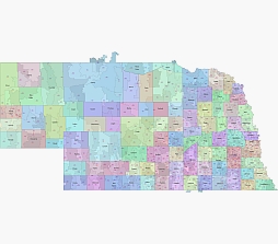
About Nebraska zip code vector map
Zip codes in Nebraska are five-digit numbers that are used to identify a specific geographic location within the state. The United States Postal Service (USPS) is responsible for assigning zip codes and delivering mail to the corresponding addresses.
Nebraska has more than 500 zip codes that cover all of its 93 counties. The first digit of a Nebraska zip code usually represents a large region of the state, while the following digits provide more specific information about the location.
Nebraska zip codes usually start with 68, 69, or 68, but there are some exceptions. For example, the Omaha area has zip codes starting with 681, while Lincoln and its surrounding areas have zip codes starting with 685.
Large map of Nebraska zip codes

Other Nebraska map: Nebraska State vector road map. Counties of West-North Central division. 7 states county map Nebraska state subdivision map, County seats of NE
