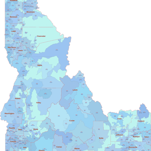
ID ZIP Code Map With Cities Counties
ID ZIP Code Map With Cities Counties Based on U.S. Census data, only standard ZIP Codes with defined land area are shown.
Price range: 17,50 $ through 25,00 $
Select optionsThis product has multiple variants. The options may be chosen on the product page
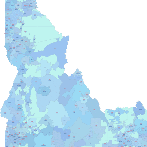
Idaho ZIP Code Map With Cities
Idaho ZIP Code Map With Cities
Price range: 17,50 $ through 20,00 $
Select optionsThis product has multiple variants. The options may be chosen on the product page
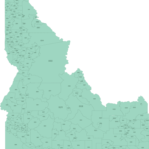
Idaho ZIP Code Map Basic
Idaho ZIP Code Map Basic: Only standard ZIP Codes with geographic areas are included. Unique-use and PO Box-only ZIPs are excluded.
Price range: 10,00 $ through 15,00 $
Select optionsThis product has multiple variants. The options may be chosen on the product page
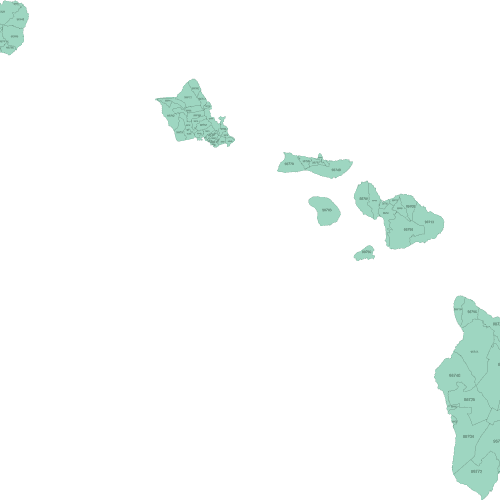
Hawaii ZIP Code Map Basic
Hawaii ZIP Code Map Basic. It's a schematic design, showing boundaries only, with no additional labels for cities or counties.
Price range: 10,00 $ through 12,00 $
Select optionsThis product has multiple variants. The options may be chosen on the product page
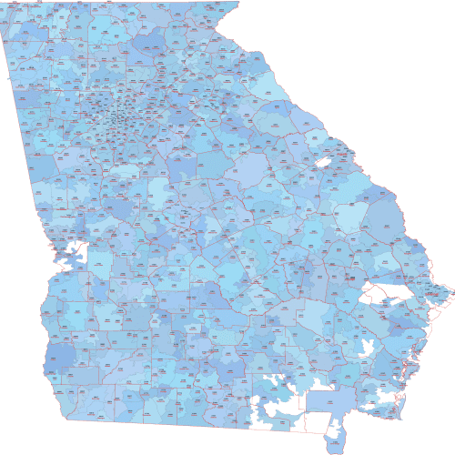
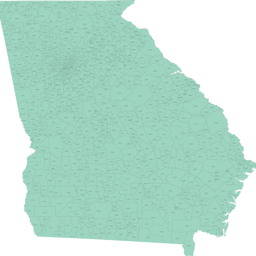
Georgia ZIP Code Map With Cities Counties
Georgia ZIP Code Map With Cities Counties displays only standard ZIP Codes with geographic extents.
Price range: 22,50 $ through 25,00 $
Select optionsThis product has multiple variants. The options may be chosen on the product page
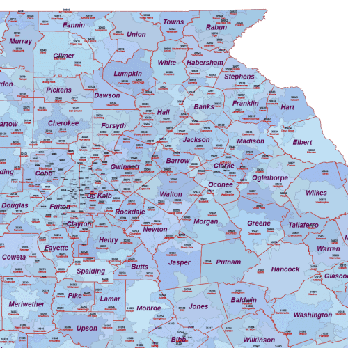
Georgia ZIP Code Map With Cities
Georgia ZIP Code Map With Cities only ZIP Codes with land area are shown — based on the latest U.S. Census boundaries.
Price range: 17,50 $ through 20,00 $
Select optionsThis product has multiple variants. The options may be chosen on the product page
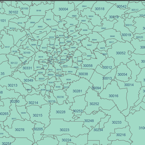
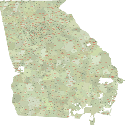
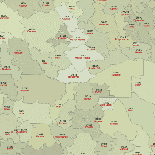
Georgia ZIP Code Map Basic
Georgia ZIP Code Map Basic displays every 5-digit postal zone that has a defined land area. It uses 5-digit standard ZIP codes
Price range: 12,50 $ through 15,00 $
Select optionsThis product has multiple variants. The options may be chosen on the product page
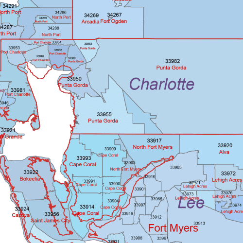
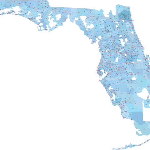
FL ZIP Code Map With Cities Counties
FL ZIP Code Map With Cities Counties displays only standard ZIP Codes with geographic extents. ZIPs with no land area are not included.
Price range: 22,50 $ through 25,00 $
Select optionsThis product has multiple variants. The options may be chosen on the product page
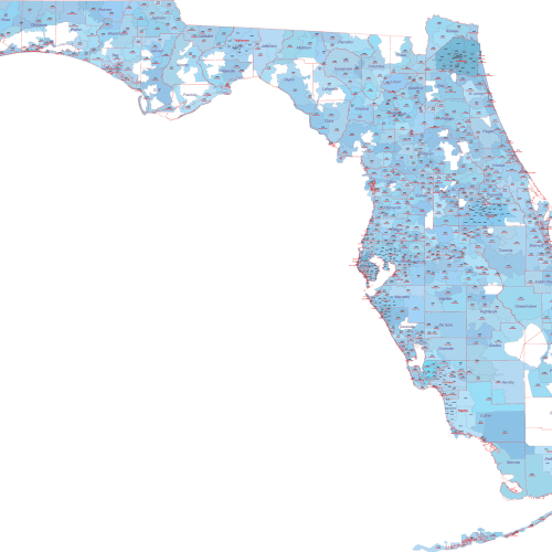
Florida ZIP Code Map With Cities
Florida ZIP Code Map With Cities features each mappable 5-digit postal zone in a distinct shade.
Price range: 17,50 $ through 20,00 $
Select optionsThis product has multiple variants. The options may be chosen on the product page