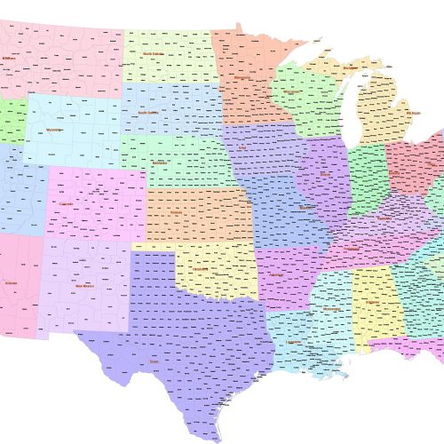
County map of Contiguous US
County map of Contiguous US refers to the 48 adjoining states. 3.002 counties and parishes colored by states. The map has the Albert Equal projection
Original price was: 35,00 $.29,90 $Current price is: 29,90 $.
Add to cart
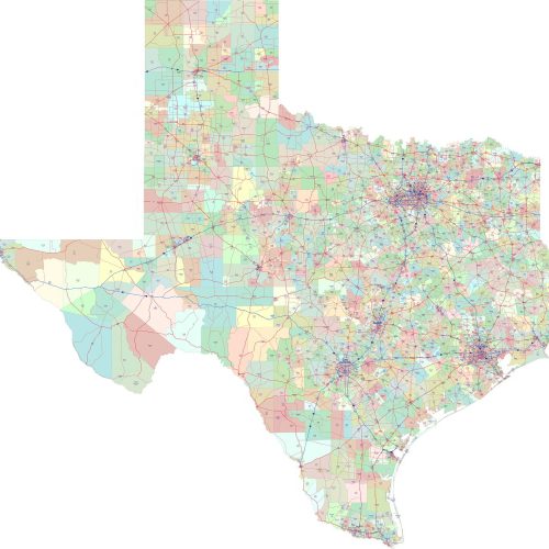
Texas ZIP CODES Roads Map
Texas ZIP CODES Roads Map with 7 layers. Adobe Illustrator (2022) vector file. 5-digit zip code, route shields, primary city.
Original price was: 35,00 $.29,90 $Current price is: 29,90 $.
Add to cart
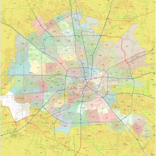
Houston ZIP Code Map
Houston ZIP Code Map with 5-digit numbers, in the background, all street lines. ZIP Code area is uniquely colored for easy differentiation
Original price was: 35,00 $.29,90 $Current price is: 29,90 $.
Add to cart
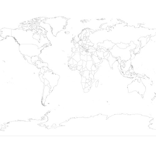
World outline map
World outline map: Royalty-free vector map with individually selectable countries, Gall projection. Black and White
1,00 $
Select optionsThis product has multiple variants. The options may be chosen on the product page
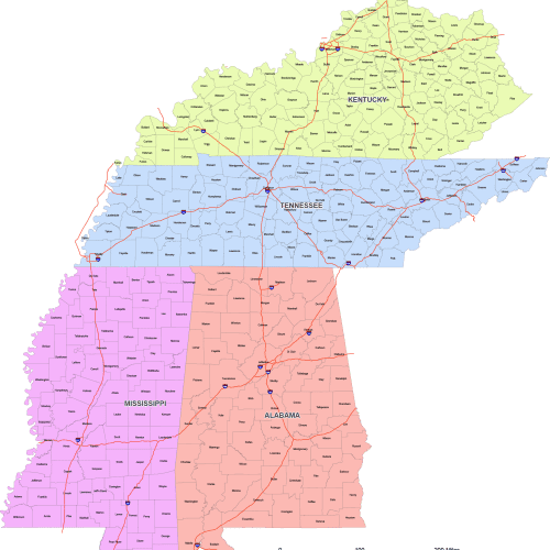
East South Central Region Map
East South Central Region map is designed using the East South Central County Map—perfect for accurate, proportional mapping of the U.S.
Price range: 32,00 $ through 36,00 $
Select optionsThis product has multiple variants. The options may be chosen on the product page
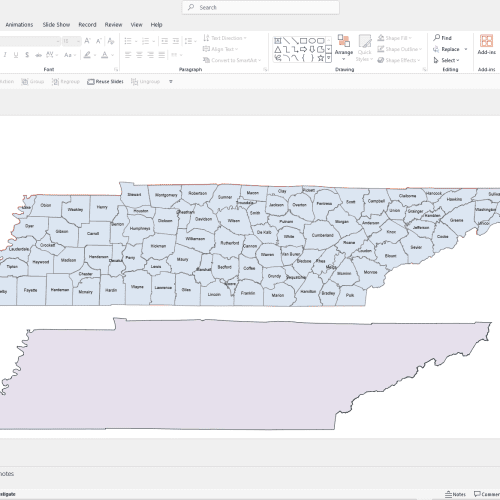
Tennessee PowerPoint Map
Tennessee PowerPoint Map: A file with a PPTX extension. It contains counties and names.
12,00 $
Add to cart
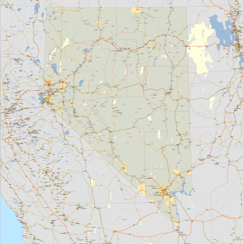
Nevada and Surrounding States
Nevada and Surrounding States, covering portions of California, Utah, Arizona, Idaho, and Oregon.
Price range: 49,90 $ through 59,00 $
Select optionsThis product has multiple variants. The options may be chosen on the product page
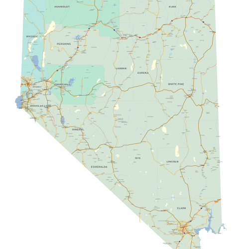
Detailed Nevada Map
Explore Detailed Nevada map with precision using this professionally crafted, high-resolution map set available in both Adobe Illustrator and layered PDF formats.
Price range: 39,90 $ through 45,00 $
Select optionsThis product has multiple variants. The options may be chosen on the product page
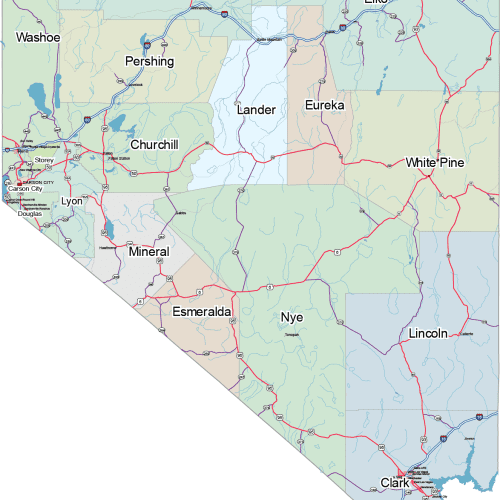
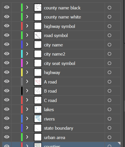
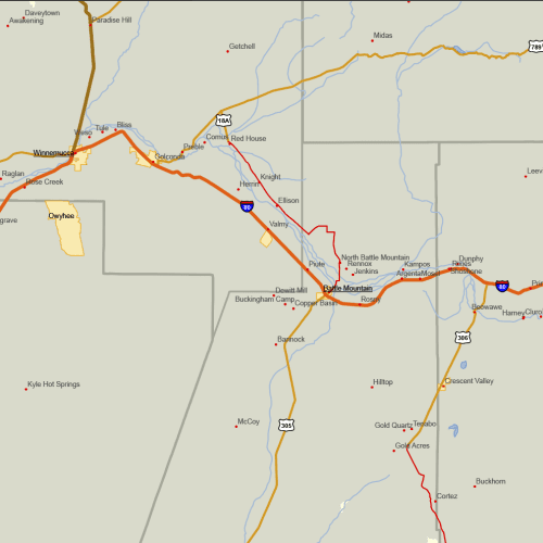
Nevada Road and City Map
The Nevada Road and City Map displays a wide range of features, including major roads, cities, and larger settlements. Rivers, lakes. AI, PDF.
Price range: 19,90 $ through 24,90 $
Select optionsThis product has multiple variants. The options may be chosen on the product page