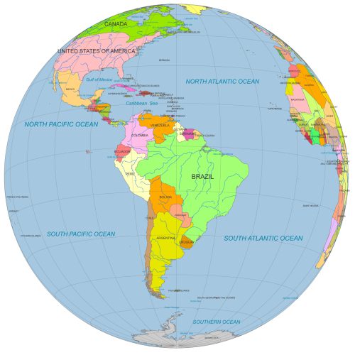
South America Globe Map PDF
South America Globe Map PDF Ideal for designers, educators, and data visualization projects focused on South America.
Price range: 12,00 $ through 15,00 $
Select optionsThis product has multiple variants. The options may be chosen on the product page
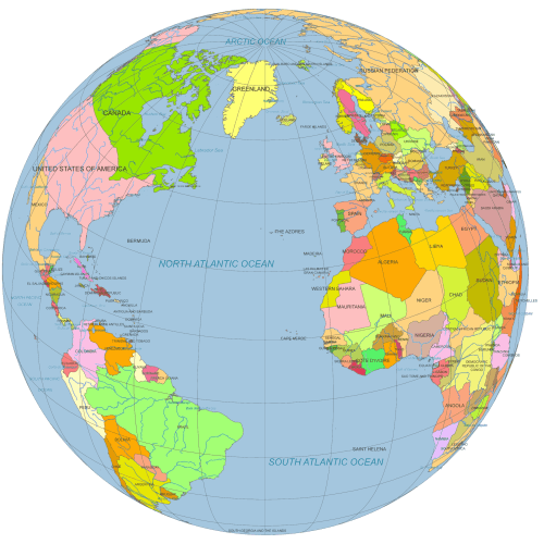
Vector Globe North America to Europe
Vector Globe North America to Europe (30°N, 30°W). Designed for professional use, ideal for editorial, educational, or presentation purposes.
Price range: 12,00 $ through 15,00 $
Select optionsThis product has multiple variants. The options may be chosen on the product page
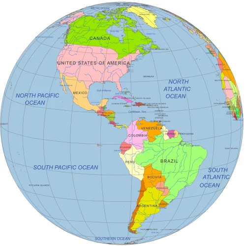
America on Globe map
America on globe map - North and South - with countries, water bodies, and graticules: Adobe Illustrator and PDF files.
Price range: 12,00 $ through 15,00 $
Select optionsThis product has multiple variants. The options may be chosen on the product page
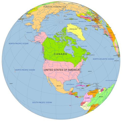
North America Centered Globe
North America Centered Globe map with main waterbodies, and country names. Graticules. Angle:50°North-100°West
Price range: 12,00 $ through 15,00 $
Select optionsThis product has multiple variants. The options may be chosen on the product page
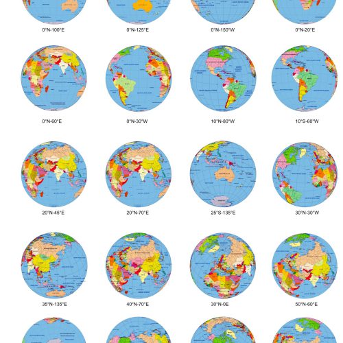
20 colored Globe from Space, in different angle.
The Adobe Illustrator file collects 20 different views of Globe from Space. Each map presents the Earth in a unique view
Original price was: 95,00 $.75,00 $Current price is: 75,00 $.
Add to cart