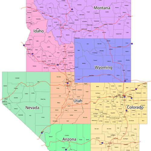
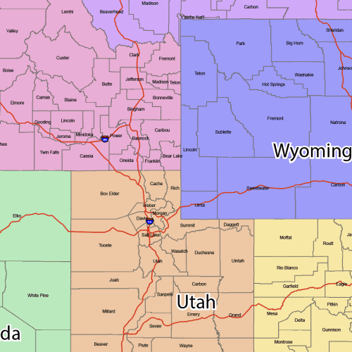
GeoPrime: Mountain Region County Map
GeoPrime: Mountain Region County Map is perfect for accurate, proportional mapping of the U.S. Fully editable and layered file.
Price range: 55,00 $ through 59,90 $
Select optionsThis product has multiple variants. The options may be chosen on the product page
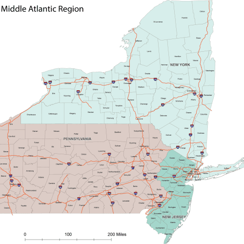
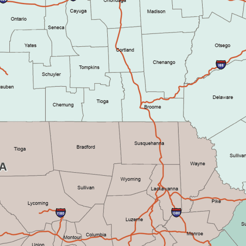
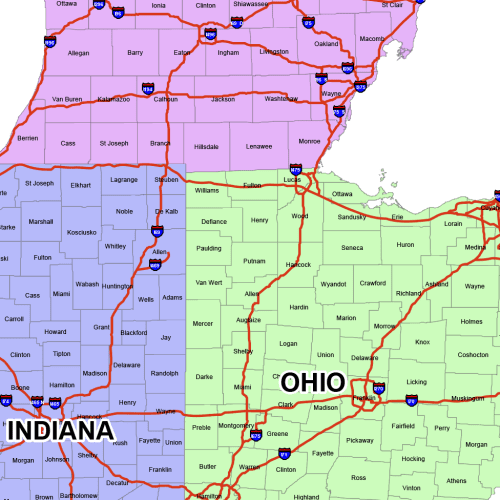
ProGrade Middle Atlantic County Map
ProGrade Middle Atlantic County Map, Adobe Illustrator and Layered PDF Map
Price range: 19,90 $ through 24,90 $
Select optionsThis product has multiple variants. The options may be chosen on the product page
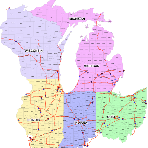
East North Central County Map
East North Central County Map
Price range: 42,00 $ through 45,00 $
Select optionsThis product has multiple variants. The options may be chosen on the product page
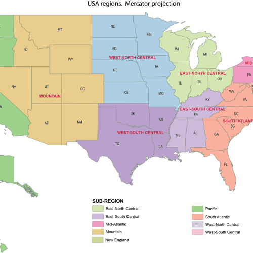
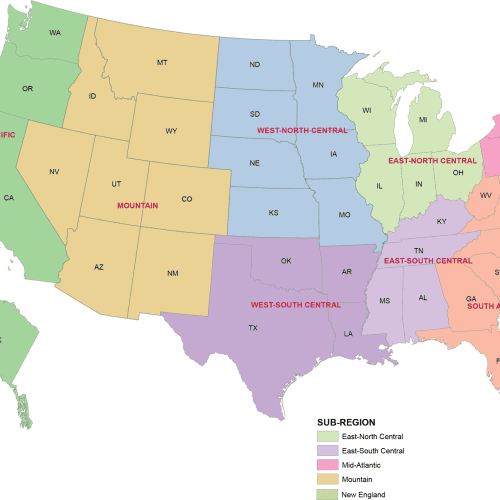
US Regions Mercator Map
US Regions Mercator Map proportional mapping of the U.S.
Price range: 14,50 $ through 15,00 $
Select optionsThis product has multiple variants. The options may be chosen on the product page

US Regions Albers Map
US Regions Albers Map Adobe Illustrator (.AI) file – fully editable and layered
Price range: 14,50 $ through 15,00 $
Select optionsThis product has multiple variants. The options may be chosen on the product page
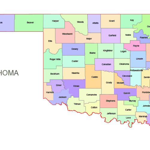
Oklahoma Colored County Map
Oklahoma Colored County Map: A high-quality, fully editable vector map of Oklahoma, AI, and Layered PDF file. Instant download.
Price range: 10,00 $ through 12,00 $
Select optionsThis product has multiple variants. The options may be chosen on the product page
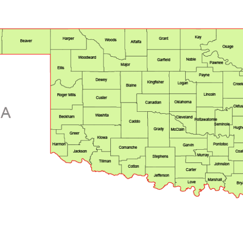
Oklahoma Vector County Map
Oklahoma Vector County Map is a professionally designed Illustrator artwork. The map supports infinite magnification.
Price range: 8,00 $ through 10,00 $
Select optionsThis product has multiple variants. The options may be chosen on the product page
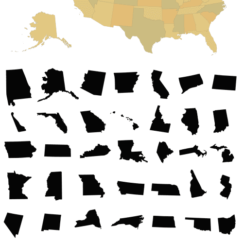
United States 50-State Silhouette Map
United States 50-State Silhouette Map. Each state is on a separate layer. AI,EPS
12,00 $
Select optionsThis product has multiple variants. The options may be chosen on the product page
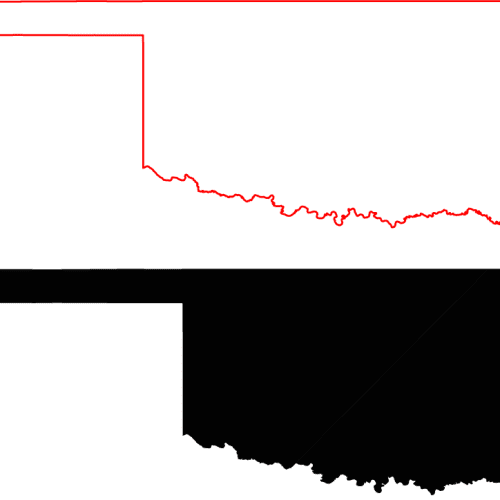
Oklahoma Free Silhouette Map
Oklahoma Free Silhouette Map download: free_silhouette_map.ai oklahoma_free_silhouette_map.pdf