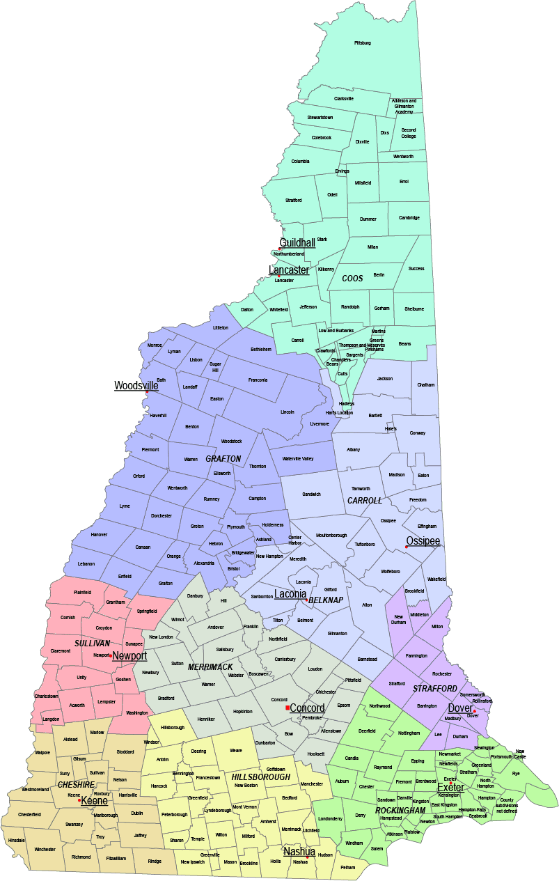
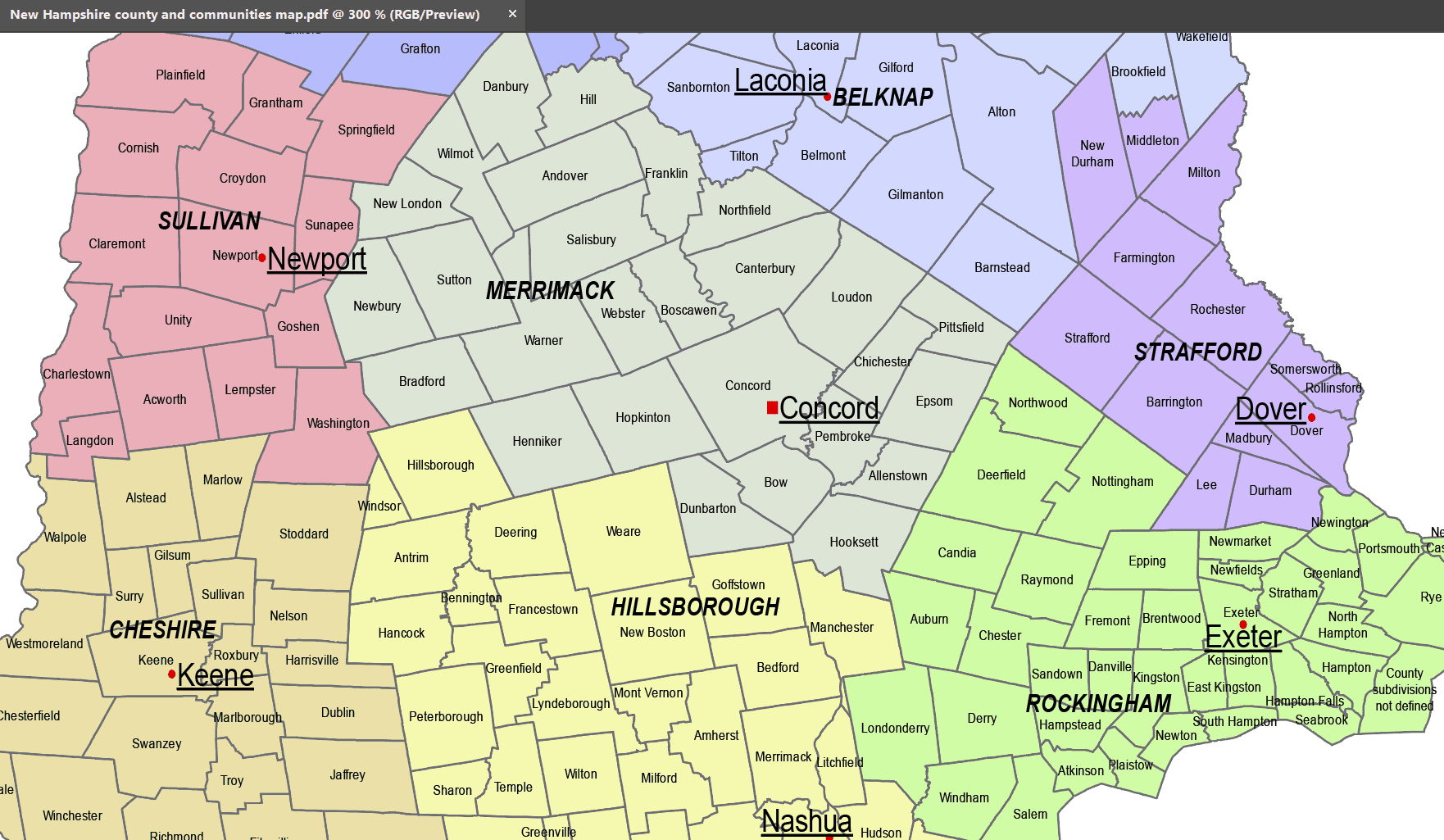
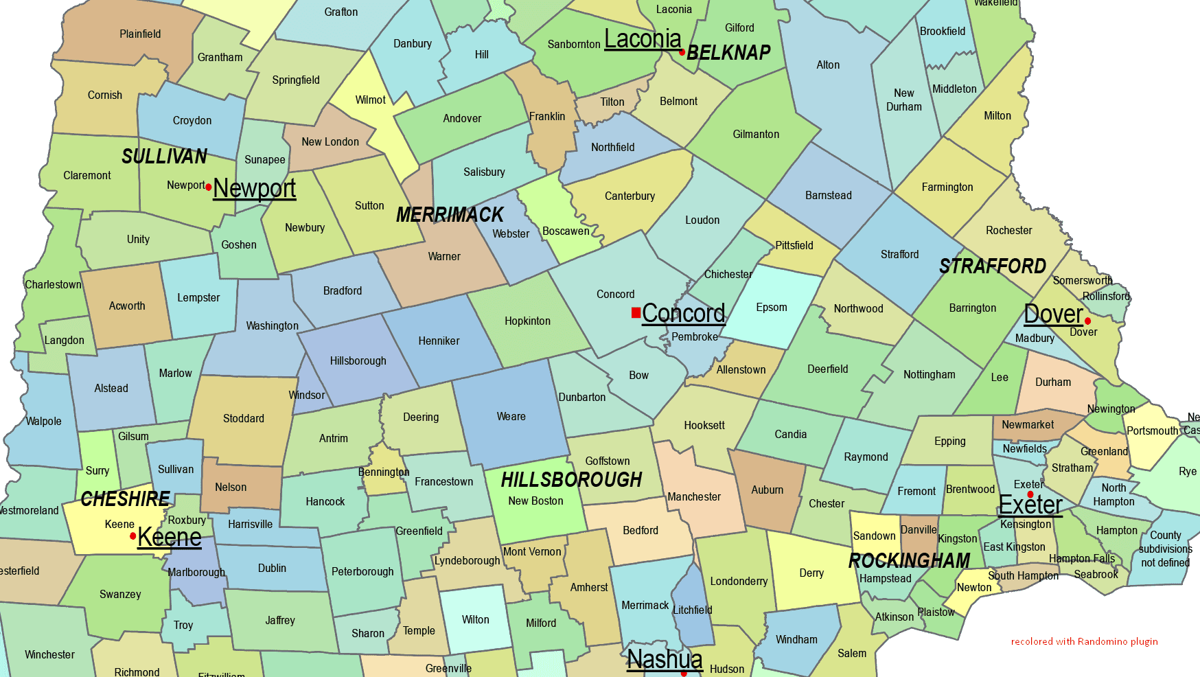
Description
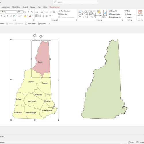
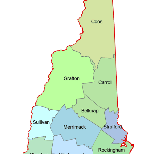
The New Hampshire County and Communities Map showcases cities, districts, villages, boroughs, barrios, townships, and precincts in a detailed Adobe Illustrator artwork. It includes all counties and subcounties, with names clearly labeled for easy reference. County seats are featured on a separate layer, while distinct colors differentiate counties and their subdivisions.
Layers
- name of subdivision
- name of the counties
- county seat markers
- subdivision shapes
Townships in New Hampshire:
Concord, Manchester, Nashua, Portsmouth, Keene, Dover, Rochester, Laconia, Claremont, Lebanon, Derry, Salem, Londonderry, Exeter, Hudson, Merrimack, Goffstown, Bedford, Milford, Amherst, Windham, Pelham, Plaistow, Hanover, Durham, Raymond, Hooksett, Conway, Peterborough, Littleton


Reviews
There are no reviews yet.