Jersey City Vector Map New Jersey
45,00 $
AI customizable styling, scalabilityPDF cross-platform compatibility
- Description
- Reviews (0)
Description
Editable Vector Map of Jersey City, NJ – Adobe Illustrator Format with NYC Zip Codes, Neighborhoods & Landmarks
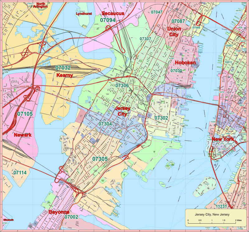
This highly detailed Jersey City Vector Map New Jersey covers 55 square miles and is built for professional use in Adobe Illustrator 2022. The map also includes adjacent zones in New York City, making it ideal for cross-regional planning, presentations, and urban analysis.
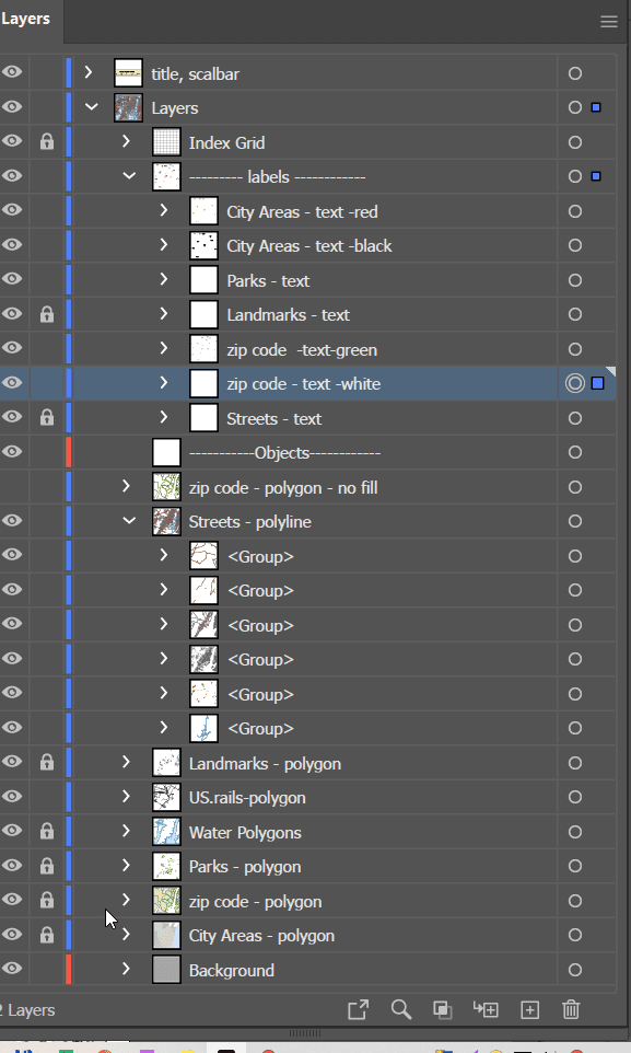
With 15 fully editable layers, this scalable vector file features everything from highways and street grids to zip code areas, parks, landmarks, and civic zones—all with editable, live text labels for easy customization.
Map Features:
✅ 17 Custom Illustrator Layers Include:
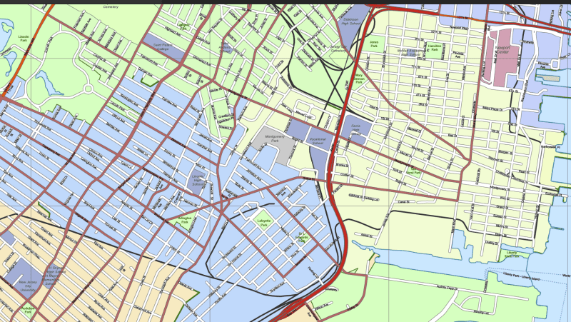
- Highways, state routes, and local street network (polylines)
- City areas and boroughs (polygons and editable text)
- Parks, water bodies, rivers, and urban green zones
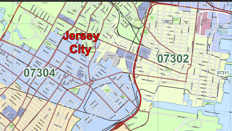
- Landmarks: schools, shopping malls, airports, and universities
- Clearly labeled zip code areas for NJ and NYC
- Editable text for neighborhoods, city zones, and landmarks
✅ Areas & Locations Covered:
This map includes detailed layouts for:
- New Jersey Areas: Jersey City, Bayonne, Union City, Secaucus, Kearny, Lyndhurst, Newark
- New York City Additions: Lower Manhattan, including zip zones for SoHo, Tribeca, Financial District, and Battery Park
✅ Included Zip Codes:
- New Jersey: 07032, 07094, 07307, 07306, 07302, 07304, 07305
- New York: 10014, 10013, 10272, 10007, 10038, 10004
✅ Notable Points of Interest:
- Hudson Mall
- New Jersey City University
- Proximity to the PATH train, Liberty State Park, and Holland Tunnel zones
✅ Technical Details:
- Format: Adobe Illustrator (.AI)
- Illustrator Version: 2022 and newer
- File Size: ~5 MB
- Fully editable, scalable vector elements
- Organized layers for effortless customization
Perfect For:
✔️ Cross-border urban planning and zoning
✔️ NYC/NJ real estate and retail mapping
✔️ Transit, signage, or infrastructure design
✔️ Educational, civic, and GIS-related use
HI-RES IMAGE OF MAP

Reviews
There are no reviews yet.