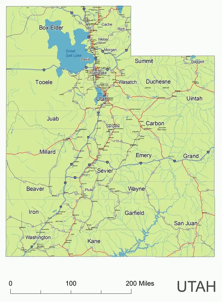
A map of Utah includes interstates, US Highways and State routes
Tremendously hard to find a good Utah map.
Layers
![]() | _county name black of state |
JPG: 2953 x 4016 at 300 dpi
Cities on Utah vector map
City Ogden Ogden Ogden Ogden Ogden Price Blanding Bluff Castle Dale Cisco Clawson Cleveland East Carbon Elmo Emery Ferron Green River Helper Huntington Kenilworth La Sal Moab Lake Powell Montezuma Creek Monticello Orangeville Sunnyside Thompson Wellington Provo Provo Provo Aurora Morgan Mountain Home Myton Neola North Salt Lake Oakley Hill Afb Orem Orem Park City Peoa Pleasant Grove Randlett Randolph Riverton Roosevelt Roy Rush Valley Sandy Stockton Tabiona Talmage Tooele Syracuse Tridell Vernal Vernon Wallsburg Wendover West Jordan Whiterocks Woodruff Woods Cross West Jordan Sandy Sandy Sandy South Jordan Herriman Orem Park City Salt Lake City
Brigham City Cache Junction Clarkston Collinston Corinne Cornish Deweyville Eden Fielding Garland Grouse Creek Honeyville Hooper Howell Huntsville Hyde Park Hyrum Lewiston Logan Mantua Mendon Millville Newton Paradise Park Valley Plymouth Portage Providence Richmond Riverside Smithfield Snowville Tremonton Trenton Wellsville Willard Logan Loa Lyman Marysvale Milford Minersville Modena Monroe Mount Carmel Newcastle New Harmony Orderville Panguitch Paragonah Parowan Duck Creek Village Rockville Bryce Santa Clara Sevier Springdale

Other Utah digital map
UT state zip code kml , UT 5-digit-zip code map, UT county map, UT subdivision map, Counties of Mountain region, UT free contour map, County seates and FIPS code of UT, Utah old map , UT colored county map
The Utah State vector road map. file in vector format enable the user organise level of structuring of map.
A vector file (ai, pdf) has flexible tools for displaying elements of maps
- you can discrete or arbitrary scaling map
- performing group operation with selected features
- changing the orders of displaying layers
- switching in/off displaying os any layers
- changing attributes of selected object ( recolour, modify outline thick, transparency, symbols)
- adding or changing features of any items, (i.e. font type)
- copying and moving particular shapes
- merging different shapes (i.e. counties)
- adding, removing cartography symbols
For editing ai, pdf file use the most common Adobe Illustrator (version 10 or higher) or CorelDRAW (version 10 or higher). If you don't have Adobe Illustrator or Corel you can choose
free open source Inkscape - 57 MB -(Windows, Mac, Linux platform ) or Scribus (Windows, Mac, Linux (54 MB)