
US-NY-Tioga-county-map vector map. Adobe Illustrator file. 2,3 MB. Cities, rivers, roads, lakes
etc. Data source: U.S. Geological Survey

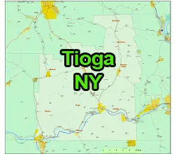
Location:
- Region: Southern Tier, Upstate New York
- Adjacent Counties:
- Chemung County (to the west)
- Broome County (to the north)
- Cortland County (to the east)
- Tompkins County (to the northeast)
- Bradford County, Pennsylvania (to the south)
County Seat:
The county seat is Owego.
Towns and Villages:
- owns: Barton, Berkshire, Candor, Newark Valley, Nichols, Owego (largest town by population), Richford, Spencer, Tioga, and Virgil
- Villages: Owego (the only incorporated village in Tioga County), Newark Valley, Nichols, Spencer, and Candor
Major Highways in US-NY-Tioga-county-map
Tioga County is served by several major highways, including NY-17 (Future I-86), NY-96, NY-38, and NY-79.
The US-NY-Tioga-county-map file in vector format enable the user organise level of structuring of map.
A vector file (ai, pdf) has flexible tools for displaying elements of maps
- you can discrete or arbitrary scaling map
- performing group operation with selected features
- changing the orders of displaying layers
- switching in/off displaying os any layers
- changing attributes of selected object ( recolour, modify outline thick, transparency, symbols)
- adding or changing features of any items, (i.e. font type)
- copying and moving particular shapes
- merging different shapes (i.e. counties)
- adding, removing cartography symbols
For editing ai, pdf file use the most common Adobe Illustrator (version 10 or higher) or CorelDRAW (version 10 or higher). If you don't have Adobe Illustrator or Corel you can choose
free open source Inkscape - 57 MB -(Windows, Mac, Linux platform ) or Scribus (Windows, Mac, Linux (54 MB)