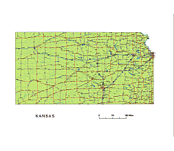
Kansas State Vector Road Map.

Kansas State Vector Road Map.

Kansas State vector road map.

Kansas State National and State Highways map
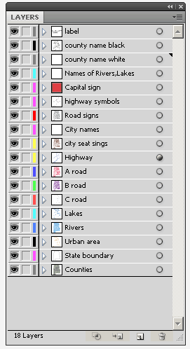
Kansas vector map-layers

Layers

-county name black of state Kansa

-country name white of state Kansas

-names of rivers, lakes of state Kansas
-capital sign of state Kansas
-highway symbols of state Kansas
-road signs state Kansas
-city names of state Kansas
-highway – lines of state Kansas
-A road lines of state Kansas
-B road lines of state Kansas
-C road lines of state Kansas
-lakes of state Kansas
-rivers of state Kansas
-urban areas of state Kansas
-state border os state Kansas
-counties of state  Kansas

Kansas State vector road map.

Kansas State Vector Road Map

More Kansas maps:

5 digit zip code map of Kansas    Subdivision map of Kansas

Ukraine Bakhmut, Alchevsk, Sievierodonetsk map

Bakhmut raion (district) and Alchevsk raion (district) all settlements location on vector map

Ukraine Bakhmut, Alchevsk, Sievierodonetsk mapBakhmut and Alchevsk raions (district) in Luhansk, Ukraine on vector map. Every settlement, village and town can be found on its map. Orientation is assisted by a scalbar.
5 layers. Illustrator cs5 file. File size: 615 KB. Formats: AI, PDF

Ukraine Bakhmut, Alchevsk, Sievierodonetsk map

Ukraine Bakhmut District, Ukraine Alchevsk District Vector Map. All Settlements.

Top