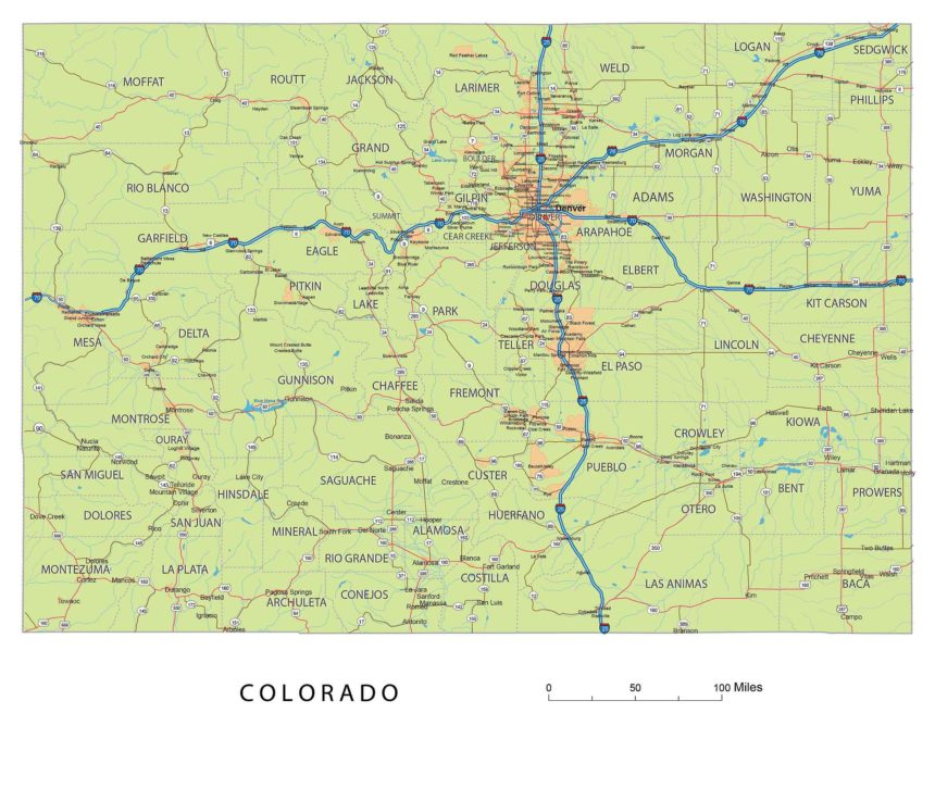
The Colorado road network map is a fantastic tool for designers and anyone looking to explore the beauty of Colorado. This map is not only editable and printable, but it also boasts vibrant colors that truly bring the state to life. With detailed information on cities, rivers, and roads all conveniently placed on 17 layers, this map provides everything you need to navigate and appreciate the wonders of Colorado. Whether you’re a professional designer or simply a curious traveler, the Colorado vector map is a must-have addition to your collection.
| Layers -county name black of state Colorado -country name white of state Colorado -names of rivers, lakes of state Colorado -capital sign of state Colorado -highway symbols of state Colorado -road signs state Colorado -city names of state Colorado -highway – lines of state Colorado -A road lines of state Colorado -B road lines of state Colorado -C road lines of state Colorado -lakes of state Colorado -rivers of state Colorado -urban areas of state Colorado -state border os state Colorado -counties of state Colorado |
Colorado road network map
Metro Areas:
Boulder Area, Breckenridge Area, Cañon City Area, Colorado Springs Area, Craig Area, Denver Area, Durango Area, Edwards Area, Fort Collins Area, Fort Morgan Area, Glenwood Springs Area, Grand Junction Area, Greeley Area, Montrose Area, Pueblo Area, Steamboat Springs Area, Sterling Area
Major Cities:
Arvada, Aurora, Boulder, Brighton, Broomfield, Cañon City, Centennial, Colorado Springs, Commerce City, Denver, Durango, Englewood, Evans, Fort Collins, Fountain, Fruita, Golden, Grand Junction, Greeley, Greenwood Village, Lafayette, Lakewood, Littleton, Longmont, Louisville, Loveland, Montrose, Northglenn, Pueblo, Sterling, Thornton, Westminster, Wheat Ridge
Major Towns:
Castle Rock, Erie, Parker, Superior, Windsor
Interstates in Colorado road network map:
North-South interstates include: Interstate 25. East-West interstates include: Interstate 70 and Interstate 76.Colorado Routes on map:
US Highways and State Routes include: Route 24, Route 34, Route 36, Route 40, Route 50, Route 84, Route 85, Route 138, Route 160, Route 285, Route 287, Route 350, Route 385, Route 491 and Route 550.

