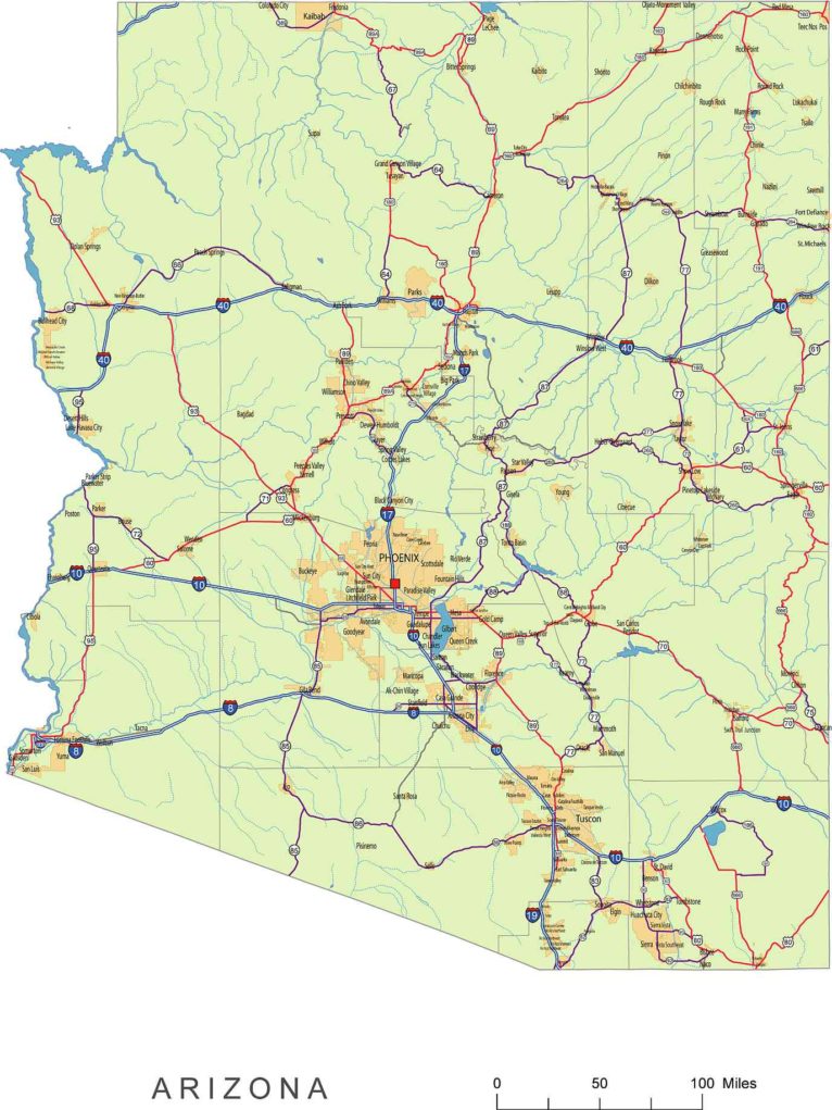
Arizona vector road map
Layers-county name black of state Arizona -country name white of state Arizona -names of rivers, and lakes of state Arizona -a capital sign of the state of Arizona -highway symbols of the state of Arizona -road signs state Arizona -City names of state Arizona -highway – lines of state Arizona -A road line of the state of Arizona -B road lines of state of Arizona -C road lines of the state of Arizona -lakes of the state of Arizona -rivers of the state of Arizona -urban areas of the state of Arizona -state border of the state of Arizona -counties of the state of Arizona |
Arizona vector road map shows majos cities
Apache Junction, Avondale, Bullhead City, Casa Grande, Chandler, Douglas, El Mirage, Eloy, Flagstaff, Glendale, Goodyear, Kingman, Lake Havasu City, Maricopa, Mesa, Nogales, Peoria, Phoenix, Prescott, San Luis, Scottsdale, Sierra Vista, Somerton, Surprise, Tempe, Tucson, Yuma
Major Towns:
Buckeye, Florence, Fountain Hills, Gilbert, Marana, Oro Valley, Payson, Prescott Valley, Queen Creek, Sahuarita
Arizona vector road map shows Interstates highways
North-South interstates include Interstate 15, Interstate 17, and Interstate 19. East-West interstates include Interstate 8, Interstate 10, and Interstate 40.Arizona Routes:
US Highways and State Routes include Route 60, Route 70, Route 89, Route 89A, Route 93, Route 95, Route 160, Route 180, and Route 191.
Other Arizona map
Arizona 3 digit zip code map, County seats and FIPS codes AI map of AZ, NM, CO, UT states

