A map of New Jersey includes interstates, US Highways and State routes
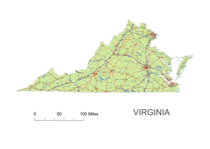
Virginia state vector road map standalone state map fucosed on road network. Indicates three types of roads. Road numbers are drawn with typical map symbols.
Interstate and primary highways
Interstate I-64 I-264 I-464 I-564 I-664
I-66 I-73 and I-74 I-81 I-381 I-581 I-85 I-785 I-87 I-95 I-195 I-295 I-395 I-495
Cities on map
Richmond, Newport News, Hampton, Suffolk, Franklin, Courtland, Capron, Newsoms, Waverly, Dendron, Surry, Ivor, Albeda, Chase City, Clover, Phenix, Hampden Sydney and more (cca 150 city names)
Jpg image: 4950 x 3525 pixel at 300 dpi
Layers
| _capital sign of state Virginia _highway symbols of state Virginia |
Other Virginia maps: 3 digit zip code map of Virginia, 5-digit-zip code of VA, Great Arlington and Washington DC, Counties of VA, Counties and municipalities of VA,

