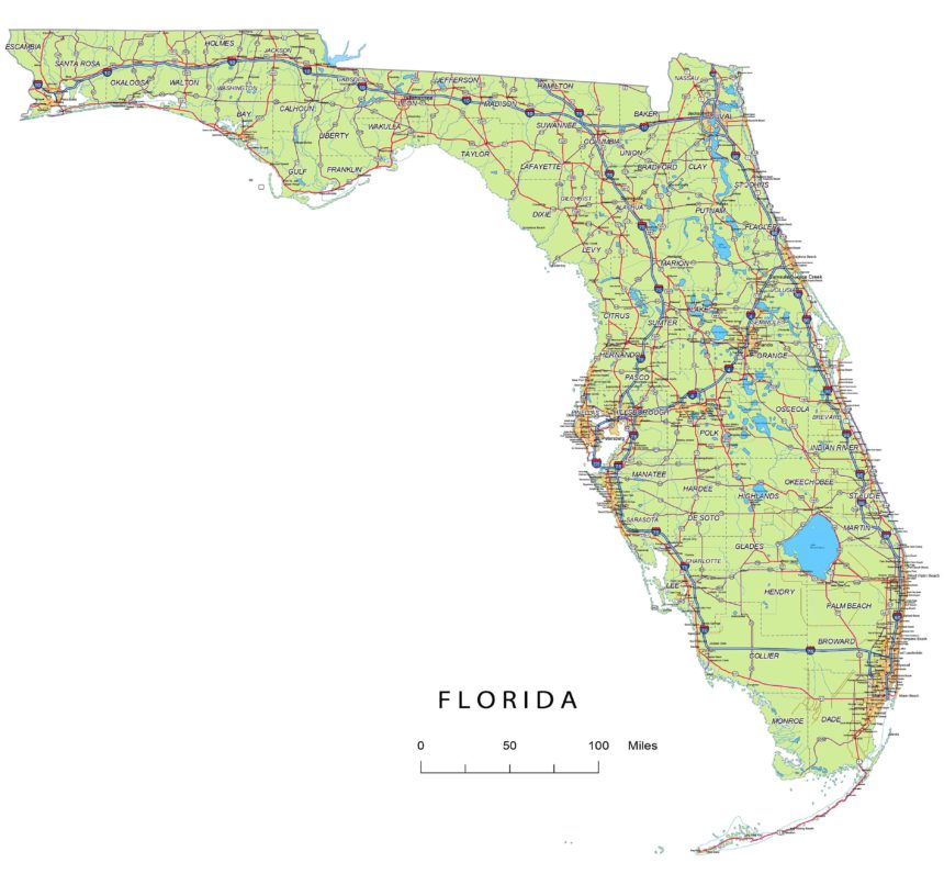
Florida state vector road map
Florida has an extensive road network, as it is the third-most populous state in the United States and a popular destination for tourists. The road system includes a variety of highways, interstates, and local roads. Some key elements of Florida’s road network include:
Interstate Highways: Florida is served by several major interstate highways, including I-75, I-95, I-10, I-4, I-275, I-595, and I-295. These highways connect major cities within the state and provide crucial transportation links to neighboring states.
Florida’s Turnpike: The Florida Turnpike is a toll road that spans the length of the state, from the southern tip in Miami to the northern border with Georgia. It provides a convenient north-south route for travelers and is a major transportation artery.
Florida State vector road map Adobe Illustrator file in 17 layers.
U.S. Highways: Various U.S. highways traverse Florida, including U.S. 1, U.S. 41, U.S. 27, and U.S. 98. These highways offer alternative routes to interstate highways and connect many cities and regions.
State Roads: Florida maintains a vast network of state roads, which are numbered and provide connectivity to more local areas, including rural and suburban regions.
Local Roads: Within cities and municipalities, you’ll find a grid of local roads, streets, and avenues, which vary in size and capacity based on the area’s population and traffic needs.
Florida State vector road map is an printable high quality map.
Bridges and Tunnels: Florida has numerous bridges and tunnels to connect its many islands and waterways, with some of the most famous examples being the Sunshine Skyway Bridge and the Seven Mile Bridge in the Florida Keys.
Toll Roads: Florida has a significant number of toll roads, which help fund road maintenance and expansion. SunPass and E-PASS are the main electronic toll collection systems in use.
Scenic Highways: Florida offers several scenic byways that showcase the state’s natural beauty and attractions. Examples include the A1A Scenic and Historic Coastal Byway along the Atlantic Ocean and the Florida Keys Scenic Highway.
Hello
Personalize the map. Redraw, edit, change colors Florida State vector road map.
Public Transportation: In addition to roads, Florida also has public transportation systems in major metropolitan areas. For example, Miami has Metrorail and Metromover, while Orlando has the Lynx bus system and SunRail commuter rail.
Layers
| Layers -county name black of state Florida -country name white of state Florida -names of rivers, lakes of state Florida -capital sign of state Florida -highway symbols of state Florida -road signs state Florida -city names of state Florida -highway – lines of state Florida -A road lines of state Florida -B road lines of state Florida -C road lines of state Florida -lakes of state Florida -rivers of state Florida -urban areas of state Florida -state border os state Florida -counties of state Florida |


