
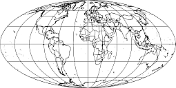
Simple World Mollweide map is an outline map. It should be filled with content and color.
Elliptical world outline map.
Earth representations available in the most familiar projection. These are Mercator, Robinson, Moollweide, Plate Carreé,The ellipsoid idea is facilitated by the grawticules that appear every 30 degrees.
Simple World Mollweide mapis available in various vector forms as AI, EPS, PDF, SVG, CDR, WMF. Absolute free = $0.00
You can download it by entering an email address of your choice
PDF, EPS, JPG, SVG, WMF, AI format (see download link)

The Simple World Mollweide map file in vector format enable the user organise level of structuring of map.
A vector file (ai, pdf) has flexible tools for displaying elements of maps
- you can discrete or arbitrary scaling map
- performing group operation with selected features
- changing the orders of displaying layers
- switching in/off displaying os any layers
- changing attributes of selected object ( recolour, modify outline thick, transparency, symbols)
- adding or changing features of any items, (i.e. font type)
- copying and moving particular shapes
- merging different shapes (i.e. counties)
- adding, removing cartography symbols
For editing ai, pdf file use the most common Adobe Illustrator (version 10 or higher) or CorelDRAW (version 10 or higher). If you don't have Adobe Illustrator or Corel you can choose
free open source Inkscape - 57 MB -(Windows, Mac, Linux platform ) or Scribus (Windows, Mac, Linux (54 MB)