
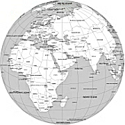
Near East center Globe, AI artwork depict our Globe from space view.
Countries of Near East According to National Geographic, the terms Near East and Middle East denote the same territories
|
|
|
1 Egypt 113,210,388
2 Turkey 84,339,607
3 Iran 89,351,259
4 Iraq 40,063,400
5 Saudi Arabia 34,719,000
6 Yemen 29,710,300
7 Syria 17,425,600
8 Jordan 10,185,500
9 United Arab Emirates 9,869,000
10 Israel 8,639,800
11 Lebanon 6,830,600
12 Palestine (West Bank and Gaza Strip) 5,148,249
13 Oman 5,081,600
14 Kuwait 4,259,500
15 Qatar 2,113,000

The Near East center Globe, AI artwork file in vector format enable the user organise level of structuring of map.
A vector file (ai, pdf) has flexible tools for displaying elements of maps
- you can discrete or arbitrary scaling map
- performing group operation with selected features
- changing the orders of displaying layers
- switching in/off displaying os any layers
- changing attributes of selected object ( recolour, modify outline thick, transparency, symbols)
- adding or changing features of any items, (i.e. font type)
- copying and moving particular shapes
- merging different shapes (i.e. counties)
- adding, removing cartography symbols
For editing ai, pdf file use the most common Adobe Illustrator (version 10 or higher) or CorelDRAW (version 10 or higher). If you don't have Adobe Illustrator or Corel you can choose
free open source Inkscape - 57 MB -(Windows, Mac, Linux platform ) or Scribus (Windows, Mac, Linux (54 MB)