
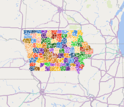
Iowa-zip-code-excel-3dmap 950 KB. Data on maps for analysis, display, presentation. To the counties or zip code, appendd any of annotation. Choose a text or image. Internet connection is required for Excel.
Columns of file:
- zip code
- primary city
- time zone
- area code
- estimated population
- typ
How to open in Excel ?
Detail from the table Iowa zip code excel 3dmap
| zip code | typ | primary city | state | county | timezone | area codes | est.population |
| 50001 | STANDARD | Ackworth | IA | Warren County | America/Chicago | 515, 641 | 640 |
| 50002 | STANDARD | Adair | IA | Adair County | America/Chicago | 641, 712 | 1160 |
| 50003 | STANDARD | Adel | IA | Dallas County | America/Chicago | 515 | 9420 |
| 50005 | STANDARD | Albion | IA | Marshall County | America/Chicago | 641 | 620 |
| 50006 | STANDARD | Alden | IA | Hardin County | America/Chicago | 515, 641 | 1500 |
| 50007 | STANDARD | Alleman | IA | Polk County | America/Chicago | 515 | 500 |
| 50008 | STANDARD | Allerton | IA | Wayne County | America/Chicago | 641, 660 | 760 |
| 50009 | STANDARD | Altoona | IA | Polk County | America/Chicago | 515 | 20510 |
| 50010 | STANDARD | Ames | IA | Story County | America/Chicago | 515 | 24010 |
| 50011 | UNIQUE | Ames | IA | Story County | America/Chicago | 515 | 75 |
| 50012 | UNIQUE | Ames | IA | Story County | America/Chicago | 515 | 62 |
| 50013 | UNIQUE | Ames | IA | Story County | America/Chicago | 515 | 80 |
| 50014 | STANDARD | Ames | IA | Story County | America/Chicago | 515 | 18360 |
| 50020 | STANDARD | Anita | IA | Cass County | America/Chicago | 641, 712 | 1210 |
| 50021 | STANDARD | Ankeny | IA | Polk County | America/Chicago | 515 | 28080 |
| 50022 | STANDARD | Atlantic | IA | Cass County | America/Chicago | 712 | 7070 |
| 50023 | STANDARD | Ankeny | IA | Polk County | America/Chicago | 515 | 42560 |
| 50025 | STANDARD | Audubon | IA | Audubon County | America/Chicago | 641, 712 | 2640 |
| 50026 | STANDARD | Bagley | IA | Guthrie County | America/Chicago | 515, 641, 712 | 430 |
| 50027 | STANDARD | Barnes City | IA | Mahaska County | America/Chicago | 641 | 210 |
| 50028 | STANDARD | Baxter | IA | Jasper County | America/Chicago | 641 | 1530 |
| 50029 | STANDARD | Bayard | IA | Guthrie County | America/Chicago | 515, 641, 712 | 530 |
| 50031 | PO BOX | Beaver | IA | Boone County | America/Chicago | 515 | 64 |
| 50032 | PO BOX | Berwick | IA | Polk County | America/Chicago | 515 | 397 |
Related files:
The Iowa-zip-code-excel-3dmap file in vector format enable the user organise level of structuring of map.
A vector file (ai, pdf) has flexible tools for displaying elements of maps
- you can discrete or arbitrary scaling map
- performing group operation with selected features
- changing the orders of displaying layers
- switching in/off displaying os any layers
- changing attributes of selected object ( recolour, modify outline thick, transparency, symbols)
- adding or changing features of any items, (i.e. font type)
- copying and moving particular shapes
- merging different shapes (i.e. counties)
- adding, removing cartography symbols
For editing ai, pdf file use the most common Adobe Illustrator (version 10 or higher) or CorelDRAW (version 10 or higher). If you don't have Adobe Illustrator or Corel you can choose
free open source Inkscape - 57 MB -(Windows, Mac, Linux platform ) or Scribus (Windows, Mac, Linux (54 MB)