
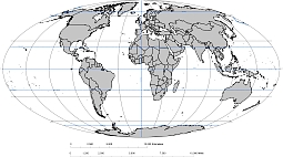
Mollweide projection world map.
Free oval world map it is a Black and White vector graphic, where country border are white lines.
The map includes a scalbar with kilometers and miles. Prime Meridian is in Greenwich, also an Africa-centered map. The famous geographic lines as Tropic of Cancer, Tropic of Capricorn, Equator, Arctic Circle, Antarctic Circle.The graphic is suitable for further designer work and use as a basis for illustration.The oval shape identified by the graticules was used every 30 degrees.

The Free oval world map file in vector format enable the user organise level of structuring of map.
A vector file (ai, pdf) has flexible tools for displaying elements of maps
- you can discrete or arbitrary scaling map
- performing group operation with selected features
- changing the orders of displaying layers
- switching in/off displaying os any layers
- changing attributes of selected object ( recolour, modify outline thick, transparency, symbols)
- adding or changing features of any items, (i.e. font type)
- copying and moving particular shapes
- merging different shapes (i.e. counties)
- adding, removing cartography symbols
For editing ai, pdf file use the most common Adobe Illustrator (version 10 or higher) or CorelDRAW (version 10 or higher). If you don't have Adobe Illustrator or Corel you can choose
free open source Inkscape - 57 MB -(Windows, Mac, Linux platform ) or Scribus (Windows, Mac, Linux (54 MB)