
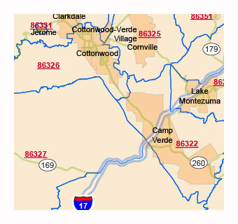
The complex file contains 11 layers, where all content is edited separately. The most important thing is that it shows the urban environment to its extent. The names of the cities are also the names of the primary zip codes. The roads are included on a semi-transparent layer together with the highway shield. It can be deleted or kept as intended.Postal codes of Arizona Highways, urban area of AZ.
Arizona ZIP Code Vector Map
Arizona ZIP Code Vector Map -list
ZIP codes of Arizona. (Click on it)
| zip code | type | primary city |
| 71601 | STANDARD | Pine Bluff |
| 71602 | STANDARD | White Hall |
| 71603 | STANDARD | Pine Bluff |
| 71611 | PO BOX | Pine Bluff |
| 71612 | PO BOX | White Hall |
| 71613 | PO BOX | Pine Bluff |
| 71630 | PO BOX | Arkansas City |
| 71631 | STANDARD | Banks |
| 71635 | STANDARD | Crossett |
| 71638 | STANDARD | Dermott |
| 71639 | STANDARD | Dumas |
| 71640 | STANDARD | Eudora |
| 71642 | STANDARD | Fountain Hill |
| 71643 | STANDARD | Gould |
| 71644 | STANDARD | Grady |
| 71646 | STANDARD | Hamburg |
| 71647 | STANDARD | Hermitage |
| 71651 | STANDARD | Jersey |
| 71652 | STANDARD | Kingsland |
| 71653 | STANDARD | Lake Village |
| 71654 | STANDARD | Mc Gehee |
| 71655 | STANDARD | Monticello |
| 71656 | PO BOX | Monticello |
| 71657 | PO BOX | Monticello |
| 71658 | STANDARD | Montrose |
| 71659 | PO BOX | Moscow |
| 71660 | STANDARD | New Edinburg |
| 71661 | STANDARD | Parkdale |
| 71662 | STANDARD | Pickens |
| 71663 | STANDARD | Portland |
| 71665 | STANDARD | Rison |
| 71666 | PO BOX | Rohwer |
| 71667 | STANDARD | Star City |
| 71670 | STANDARD | Tillar |
| 71671 | STANDARD | Warren |
| 71674 | STANDARD | Watson |
| 71675 | STANDARD | Wilmar |
| 71676 | STANDARD | Wilmot |
| 71677 | PO BOX | Winchester |
| 71678 | PO BOX | Yorktown |
| 71701 | STANDARD | Camden |
| 71711 | PO BOX | Camden |
| 71720 | STANDARD | Bearden |
| 71721 | PO BOX | Beirne |
| 71722 | STANDARD | Bluff City |
| 71724 | PO BOX | Calion |
| 71725 | STANDARD | Carthage |
| 71726 | STANDARD | Chidester |
| 71728 | PO BOX | Curtis |
| 71730 | STANDARD | El Dorado |
| 71731 | PO BOX | El Dorado |
| 71740 | STANDARD | Emerson |
| 71742 | STANDARD | Fordyce |
| 71743 | STANDARD | Gurdon |
| 71744 | STANDARD | Hampton |
| 71745 | PO BOX | Harrell |
| 71747 | STANDARD | Huttig |
| 71748 | PO BOX | Ivan |
| 71749 | STANDARD | Junction City |
| 71750 | PO BOX | Lawson |
| 71751 | STANDARD | Louann |
| 71752 | STANDARD | Mc Neil |
| 71753 | STANDARD | Magnolia |
| 71754 | PO BOX | Magnolia |
| 71758 | STANDARD | Mount Holly |
| 71759 | PO BOX | Norphlet |
| 71762 | STANDARD | Smackover |
| 71763 | STANDARD | Sparkman |
| 71764 | STANDARD | Stephens |
| 71765 | STANDARD | Strong |
| 71766 | STANDARD | Thornton |
| 71768 | STANDARD | El Dorado |
| 71770 | STANDARD | Waldo |
| 71772 | PO BOX | Whelen Springs |
| 71801 | STANDARD | Hope |
| 71802 | PO BOX | Hope |
| 71820 | PO BOX | Alleene |
| 71822 | STANDARD | Ashdown |
| 71823 | PO BOX | Ben Lomond |
| 71825 | STANDARD | Blevins |
| 71826 | STANDARD | Bradley |
| 71827 | STANDARD | Buckner |
| 71828 | PO BOX | Cale |
| 71831 | STANDARD | Columbus |
| 71832 | STANDARD | De Queen |
| 71833 | STANDARD | Dierks |
| 71834 | STANDARD | Doddridge |
| 71835 | STANDARD | Emmet |
| 71836 | STANDARD | Foreman |
| 71837 | STANDARD | Fouke |
| 71838 | STANDARD | Fulton |
| 71839 | STANDARD | Garland City |
| 71840 | PO BOX | Genoa |
| 71841 | STANDARD | Gillham |
| 71842 | STANDARD | Horatio |
| 71844 | PO BOX | Laneburg |
| 71845 | STANDARD | Lewisville |
| 71846 | STANDARD | Lockesburg |
| 71847 | STANDARD | Mc Caskill |
| 71851 | STANDARD | Mineral Springs |
| 71852 | STANDARD | Nashville |
| 71853 | STANDARD | Ogden |
| 71854 | STANDARD | Texarkana |
| 71855 | STANDARD | Ozan |
| 71857 | STANDARD | Prescott |
| 71858 | STANDARD | Rosston |
| 71859 | STANDARD | Saratoga |
| 71860 | STANDARD | Stamps |
| 71861 | STANDARD | Taylor |
| 71862 | STANDARD | Washington |
| 71864 | PO BOX | Willisville |
| 71865 | PO BOX | Wilton |
| 71866 | STANDARD | Winthrop |
| 71901 | STANDARD | Hot Springs National Park |
| 71902 | PO BOX | Hot Springs National Park |
| 71903 | PO BOX | Hot Springs National Park |
| 71909 | STANDARD | Hot Springs Village |
| 71910 | PO BOX | Hot Springs Village |
| 71913 | STANDARD | Hot Springs National Park |
| 71914 | PO BOX | Hot Springs National Park |
| 71920 | STANDARD | Alpine |
| 71921 | STANDARD | Amity |
| 71922 | PO BOX | Antoine |
| 71923 | STANDARD | Arkadelphia |
| 71929 | STANDARD | Bismarck |
| 71932 | PO BOX | Board Camp |
| 71933 | STANDARD | Bonnerdale |
| 71935 | STANDARD | Caddo Gap |
| 71937 | STANDARD | Cove |
| 71940 | STANDARD | Delight |
| 71941 | STANDARD | Donaldson |
| 71942 | PO BOX | Friendship |
| 71943 | STANDARD | Glenwood |
| 71944 | STANDARD | Grannis |
| 71945 | STANDARD | Hatfield |
| 71949 | STANDARD | Jessieville |
| 71950 | STANDARD | Kirby |
| 71951 | STANDARD | Hot Springs National Park |
| 71952 | STANDARD | Langley |
| 71953 | STANDARD | Mena |
| 71956 | STANDARD | Mountain Pine |
| 71957 | STANDARD | Mount Ida |
| 71958 | STANDARD | Murfreesboro |
| 71959 | STANDARD | Newhope |
| 71960 | STANDARD | Norman |
| 71961 | STANDARD | Oden |
| 71962 | STANDARD | Okolona |
| 71964 | STANDARD | Pearcy |
| 71965 | STANDARD | Pencil Bluff |
| 71966 | PO BOX | Oden |
| 71968 | STANDARD | Royal |
| 71969 | STANDARD | Sims |
| 71970 | STANDARD | Story |
| 71971 | STANDARD | Umpire |
| 71972 | STANDARD | Vandervoort |
| 71973 | STANDARD | Wickes |
| 71998 | UNIQUE | Arkadelphia |
| 71999 | UNIQUE | Arkadelphia |
| 72001 | STANDARD | Adona |
| 72002 | STANDARD | Alexander |
| 72003 | STANDARD | Almyra |
| 72004 | STANDARD | Altheimer |
| 72005 | STANDARD | Amagon |
| 72006 | STANDARD | Augusta |
| 72007 | STANDARD | Austin |
| 72010 | STANDARD | Bald Knob |
| 72011 | STANDARD | Bauxite |
| 72012 | STANDARD | Beebe |
| 72013 | STANDARD | Bee Branch |
| 72014 | PO BOX | Beedeville |
| 72015 | STANDARD | Benton |
| 72016 | STANDARD | Bigelow |
| 72017 | STANDARD | Biscoe |
| 72018 | PO BOX | Benton |
| 72019 | STANDARD | Benton |
| 72020 | STANDARD | Bradford |
| 72021 | STANDARD | Brinkley |
| 72022 | STANDARD | Bryant |
| 72023 | STANDARD | Cabot |
| 72024 | STANDARD | Carlisle |
| 72025 | STANDARD | Casa |
| 72026 | STANDARD | Casscoe |
| 72027 | STANDARD | Center Ridge |
| 72028 | PO BOX | Choctaw |
| 72029 | STANDARD | Clarendon |
| 72030 | STANDARD | Cleveland |
| 72031 | STANDARD | Clinton |
| 72032 | STANDARD | Conway |
| 72033 | PO BOX | Conway |
| 72034 | STANDARD | Conway |
| 72035 | UNIQUE | Conway |
| 72036 | STANDARD | Cotton Plant |
| 72037 | PO BOX | Coy |
| 72038 | STANDARD | Crocketts Bluff |
| 72039 | STANDARD | Damascus |
| 72040 | STANDARD | Des Arc |
| 72041 | STANDARD | De Valls Bluff |
| 72042 | STANDARD | De Witt |
| 72043 | PO BOX | Diaz |
| 72044 | STANDARD | Edgemont |
| 72045 | STANDARD | El Paso |
| 72046 | STANDARD | England |
| 72047 | STANDARD | Enola |
| 72048 | STANDARD | Ethel |
| 72051 | STANDARD | Fox |
| 72052 | PO BOX | Garner |
| 72053 | PO BOX | College Station |
| 72055 | STANDARD | Gillett |
| 72057 | STANDARD | Grapevine |
| 72058 | STANDARD | Greenbrier |
| 72059 | PO BOX | Gregory |
| 72060 | STANDARD | Griffithville |
| 72061 | STANDARD | Guy |
| 72063 | STANDARD | Hattieville |
| 72064 | STANDARD | Hazen |
| 72065 | STANDARD | Hensley |
| 72066 | PO BOX | Hickory Plains |
| 72067 | STANDARD | Higden |
| 72068 | STANDARD | Higginson |
| 72069 | STANDARD | Holly Grove |
| 72070 | STANDARD | Houston |
| 72072 | STANDARD | Humnoke |
| 72073 | STANDARD | Humphrey |
| 72074 | PO BOX | Hunter |
| 72075 | PO BOX | Jacksonport |
| 72076 | STANDARD | Jacksonville |
| 72078 | PO BOX | Jacksonville |
| 72079 | STANDARD | Jefferson |
| 72080 | STANDARD | Jerusalem |
| 72081 | STANDARD | Judsonia |
| 72082 | STANDARD | Kensett |
| 72083 | PO BOX | Keo |
| 72084 | STANDARD | Leola |
| 72085 | PO BOX | Letona |
| 72086 | STANDARD | Lonoke |
| 72087 | STANDARD | Lonsdale |
| 72088 | STANDARD | Fairfield Bay |
| 72089 | PO BOX | Bryant |
| 72099 | UNIQUE | Little Rock Air Force Base |
| 72101 | STANDARD | Mc Crory |
| 72102 | STANDARD | Mc Rae |
| 72103 | STANDARD | Mabelvale |
| 72104 | STANDARD | Malvern |
| 72105 | PO BOX | Jones Mill |
| 72106 | STANDARD | Mayflower |
| 72107 | PO BOX | Menifee |
| 72108 | PO BOX | Monroe |
| 72110 | STANDARD | Morrilton |
| 72111 | STANDARD | Mount Vernon |
| 72112 | STANDARD | Newport |
| 72113 | STANDARD | Maumelle |
| 72114 | STANDARD | North Little Rock |
| 72115 | PO BOX | North Little Rock |
| 72116 | STANDARD | North Little Rock |
| 72117 | STANDARD | North Little Rock |
| 72118 | STANDARD | North Little Rock |
| 72119 | PO BOX | North Little Rock |
| 72120 | STANDARD | Sherwood |
| 72121 | STANDARD | Pangburn |
| 72122 | STANDARD | Paron |
| 72123 | PO BOX | Patterson |
| 72124 | PO BOX | North Little Rock |
| 72125 | STANDARD | Perry |
| 72126 | STANDARD | Perryville |
| 72127 | STANDARD | Plumerville |
| 72128 | STANDARD | Poyen |
| 72129 | STANDARD | Prattsville |
| 72130 | STANDARD | Prim |
| 72131 | STANDARD | Quitman |
| 72132 | STANDARD | Redfield |
| 72133 | PO BOX | Reydell |
| 72134 | STANDARD | Roe |
| 72135 | STANDARD | Roland |
| 72136 | STANDARD | Romance |
| 72137 | STANDARD | Rose Bud |
| 72139 | PO BOX | Russell |
| 72140 | STANDARD | Saint Charles |
| 72141 | STANDARD | Scotland |
| 72142 | STANDARD | Scott |
| 72143 | STANDARD | Searcy |
| 72145 | PO BOX | Searcy |
| 72149 | UNIQUE | Searcy |
| 72150 | STANDARD | Sheridan |
| 72152 | STANDARD | Sherrill |
| 72153 | STANDARD | Shirley |
| 72156 | STANDARD | Solgohachia |
| 72157 | STANDARD | Springfield |
| 72158 | PO BOX | Benton |
| 72160 | STANDARD | Stuttgart |
| 72164 | PO BOX | Sweet Home |
| 72165 | STANDARD | Thida |
| 72166 | STANDARD | Tichnor |
| 72167 | STANDARD | Traskwood |
| 72168 | STANDARD | Tucker |
| 72169 | PO BOX | Tupelo |
| 72170 | PO BOX | Ulm |
| 72173 | STANDARD | Vilonia |
| 72175 | STANDARD | Wabbaseka |
| 72176 | STANDARD | Ward |
| 72178 | PO BOX | West Point |
| 72179 | STANDARD | Wilburn |
| 72180 | PO BOX | Woodson |
| 72181 | STANDARD | Wooster |
| 72182 | PO BOX | Wright |
| 72183 | PO BOX | Wrightsville |
| 72189 | UNIQUE | Mc Crory |
| 72190 | PO BOX | North Little Rock |
| 72198 | STANDARD | North Little Rock |
| 72199 | UNIQUE | North Little Rock |
| 72201 | STANDARD | Little Rock |
| 72202 | STANDARD | Little Rock |
| 72203 | PO BOX | Little Rock |
| 72204 | STANDARD | Little Rock |
| 72205 | STANDARD | Little Rock |
| 72206 | STANDARD | Little Rock |
| 72207 | STANDARD | Little Rock |
| 72209 | STANDARD | Little Rock |
| 72210 | STANDARD | Little Rock |
| 72211 | STANDARD | Little Rock |
| 72212 | STANDARD | Little Rock |
| 72214 | PO BOX | Little Rock |
| 72215 | PO BOX | Little Rock |
| 72216 | PO BOX | Little Rock |
| 72217 | PO BOX | Little Rock |
| 72219 | PO BOX | Little Rock |
| 72221 | PO BOX | Little Rock |
| 72222 | PO BOX | Little Rock |
| 72223 | STANDARD | Little Rock |
| 72225 | PO BOX | Little Rock |
| 72227 | STANDARD | Little Rock |
| 72231 | PO BOX | Little Rock |
| 72255 | UNIQUE | Little Rock |
| 72260 | PO BOX | Little Rock |
| 72295 | PO BOX | Little Rock |
| 72301 | STANDARD | West Memphis |
| 72303 | PO BOX | West Memphis |
| 72310 | PO BOX | Armorel |
| 72311 | PO BOX | Aubrey |
| 72312 | PO BOX | Barton |
| 72313 | PO BOX | Bassett |
| 72315 | STANDARD | Blytheville |
| 72316 | PO BOX | Blytheville |
| 72319 | PO BOX | Gosnell |
| 72320 | STANDARD | Brickeys |
| 72321 | PO BOX | Burdette |
| 72322 | PO BOX | Caldwell |
| 72324 | STANDARD | Cherry Valley |
| 72325 | PO BOX | Clarkedale |
| 72326 | STANDARD | Colt |
| 72327 | STANDARD | Crawfordsville |
| 72328 | PO BOX | Crumrod |
| 72329 | PO BOX | Driver |
| 72330 | STANDARD | Dyess |
| 72331 | STANDARD | Earle |
| 72332 | PO BOX | Edmondson |
| 72333 | STANDARD | Elaine |
| 72335 | STANDARD | Forrest City |
| 72336 | PO BOX | Forrest City |
| 72338 | STANDARD | Frenchmans Bayou |
| 72339 | PO BOX | Gilmore |
| 72340 | PO BOX | Goodwin |
| 72341 | PO BOX | Haynes |
| 72342 | STANDARD | Helena |
| 72346 | STANDARD | Heth |
| 72347 | STANDARD | Hickory Ridge |
| 72348 | STANDARD | Hughes |
| 72350 | STANDARD | Joiner |
| 72351 | PO BOX | Keiser |
| 72352 | PO BOX | La Grange |
| 72353 | PO BOX | Lambrook |
| 72354 | STANDARD | Lepanto |
| 72355 | STANDARD | Lexa |
| 72358 | STANDARD | Luxora |
| 72359 | PO BOX | Madison |
| 72360 | STANDARD | Marianna |
| 72364 | STANDARD | Marion |
| 72365 | STANDARD | Marked Tree |
| 72366 | STANDARD | Marvell |
| 72367 | PO BOX | Mellwood |
| 72368 | STANDARD | Moro |
| 72369 | PO BOX | Oneida |
| 72370 | STANDARD | Osceola |
| 72372 | STANDARD | Palestine |
| 72373 | STANDARD | Parkin |
| 72374 | STANDARD | Poplar Grove |
| 72376 | STANDARD | Proctor |
| 72377 | PO BOX | Rivervale |
| 72379 | PO BOX | Snow Lake |
| 72383 | PO BOX | Turner |
| 72384 | STANDARD | Turrell |
| 72386 | STANDARD | Tyronza |
| 72387 | PO BOX | Vanndale |
| 72389 | PO BOX | Wabash |
| 72390 | STANDARD | West Helena |
| 72391 | PO BOX | West Ridge |
| 72392 | STANDARD | Wheatley |
| 72394 | STANDARD | Widener |
| 72395 | STANDARD | Wilson |
| 72396 | STANDARD | Wynne |
| 72401 | STANDARD | Jonesboro |
| 72402 | PO BOX | Jonesboro |
| 72403 | PO BOX | Jonesboro |
| 72404 | STANDARD | Jonesboro |
| 72405 | STANDARD | Jonesboro |
| 72410 | STANDARD | Alicia |
| 72411 | STANDARD | Bay |
| 72412 | STANDARD | Beech Grove |
| 72413 | STANDARD | Biggers |
| 72414 | STANDARD | Black Oak |
| 72415 | STANDARD | Black Rock |
| 72416 | STANDARD | Bono |
| 72417 | STANDARD | Brookland |
| 72419 | STANDARD | Caraway |
| 72421 | STANDARD | Cash |
| 72422 | STANDARD | Corning |
| 72424 | PO BOX | Datto |
| 72425 | STANDARD | Delaplaine |
| 72426 | PO BOX | Dell |
| 72427 | PO BOX | Egypt |
| 72428 | STANDARD | Etowah |
| 72429 | STANDARD | Fisher |
| 72430 | STANDARD | Greenway |
| 72431 | PO BOX | Grubbs |
| 72432 | STANDARD | Harrisburg |
| 72433 | STANDARD | Hoxie |
| 72434 | STANDARD | Imboden |
| 72435 | STANDARD | Knobel |
| 72436 | STANDARD | Lafe |
| 72437 | STANDARD | Lake City |
| 72438 | STANDARD | Leachville |
| 72439 | STANDARD | Light |
| 72440 | STANDARD | Lynn |
| 72441 | PO BOX | Mc Dougal |
| 72442 | STANDARD | Manila |
| 72443 | STANDARD | Marmaduke |
| 72444 | STANDARD | Maynard |
| 72445 | PO BOX | Minturn |
| 72447 | STANDARD | Monette |
| 72449 | PO BOX | O Kean |
| 72450 | STANDARD | Paragould |
| 72451 | PO BOX | Paragould |
| 72453 | STANDARD | Peach Orchard |
| 72454 | STANDARD | Piggott |
| 72455 | STANDARD | Pocahontas |
| 72456 | STANDARD | Pollard |
| 72457 | PO BOX | Portia |
| 72458 | STANDARD | Powhatan |
| 72459 | STANDARD | Ravenden |
| 72460 | STANDARD | Ravenden Springs |
| 72461 | STANDARD | Rector |
| 72462 | PO BOX | Reyno |
| 72464 | PO BOX | Saint Francis |
| 72465 | PO BOX | Sedgwick |
| 72466 | STANDARD | Smithville |
| 72467 | PO BOX | State University |
| 72469 | STANDARD | Strawberry |
| 72470 | STANDARD | Success |
| 72471 | STANDARD | Swifton |
| 72472 | STANDARD | Trumann |
| 72473 | STANDARD | Tuckerman |
| 72474 | PO BOX | Walcott |
| 72475 | PO BOX | Waldenburg |
| 72476 | STANDARD | Walnut Ridge |
| 72478 | STANDARD | Warm Springs |
| 72479 | STANDARD | Weiner |
| 72482 | STANDARD | Williford |
| 72501 | STANDARD | Batesville |
| 72503 | PO BOX | Batesville |
| 72512 | STANDARD | Horseshoe Bend |
| 72513 | STANDARD | Ash Flat |
| 72515 | STANDARD | Bexar |
| 72517 | STANDARD | Brockwell |
| 72519 | STANDARD | Calico Rock |
| 72520 | STANDARD | Camp |
| 72521 | STANDARD | Cave City |
| 72522 | STANDARD | Charlotte |
| 72523 | STANDARD | Concord |
| 72524 | STANDARD | Cord |
| 72525 | PO BOX | Cherokee Village |
| 72526 | PO BOX | Cushman |
| 72527 | STANDARD | Desha |
| 72528 | STANDARD | Dolph |
| 72529 | STANDARD | Cherokee Village |
| 72530 | STANDARD | Drasco |
| 72531 | STANDARD | Elizabeth |
| 72532 | STANDARD | Evening Shade |
| 72533 | STANDARD | Fifty Six |
| 72534 | STANDARD | Floral |
| 72536 | STANDARD | Franklin |
| 72537 | STANDARD | Gamaliel |
| 72538 | STANDARD | Gepp |
| 72539 | STANDARD | Glencoe |
| 72540 | STANDARD | Guion |
| 72542 | STANDARD | Hardy |
| 72543 | STANDARD | Heber Springs |
| 72544 | STANDARD | Henderson |
| 72545 | UNIQUE | Heber Springs |
| 72546 | STANDARD | Ida |
| 72550 | STANDARD | Locust Grove |
| 72553 | PO BOX | Magness |
| 72554 | STANDARD | Mammoth Spring |
| 72555 | STANDARD | Marcella |
| 72556 | STANDARD | Melbourne |
| 72560 | STANDARD | Mountain View |
| 72561 | STANDARD | Mount Pleasant |
| 72562 | STANDARD | Newark |
| 72564 | STANDARD | Oil Trough |
| 72565 | STANDARD | Oxford |
| 72566 | STANDARD | Pineville |
| 72567 | STANDARD | Pleasant Grove |
| 72568 | STANDARD | Pleasant Plains |
| 72569 | STANDARD | Poughkeepsie |
| 72571 | STANDARD | Rosie |
| 72572 | STANDARD | Saffell |
| 72573 | STANDARD | Sage |
| 72575 | PO BOX | Salado |
| 72576 | STANDARD | Salem |
| 72577 | STANDARD | Sidney |
| 72578 | STANDARD | Sturkie |
| 72579 | STANDARD | Sulphur Rock |
| 72581 | STANDARD | Tumbling Shoals |
| 72583 | STANDARD | Viola |
| 72584 | STANDARD | Violet Hill |
| 72585 | STANDARD | Wideman |
| 72587 | STANDARD | Wiseman |
| 72601 | STANDARD | Harrison |
| 72602 | PO BOX | Harrison |
| 72611 | STANDARD | Alpena |
| 72613 | PO BOX | Beaver |
| 72615 | PO BOX | Bergman |
| 72616 | STANDARD | Berryville |
| 72617 | STANDARD | Big Flat |
| 72619 | STANDARD | Bull Shoals |
| 72623 | STANDARD | Clarkridge |
| 72624 | STANDARD | Compton |
| 72626 | STANDARD | Cotter |
| 72628 | STANDARD | Deer |
| 72629 | STANDARD | Dennard |
| 72630 | PO BOX | Diamond City |
| 72631 | STANDARD | Eureka Springs |
| 72632 | STANDARD | Eureka Springs |
| 72633 | STANDARD | Everton |
| 72634 | STANDARD | Flippin |
| 72635 | STANDARD | Gassville |
| 72636 | PO BOX | Gilbert |
| 72638 | STANDARD | Green Forest |
| 72639 | STANDARD | Harriet |
| 72640 | STANDARD | Hasty |
| 72641 | STANDARD | Jasper |
| 72642 | STANDARD | Lakeview |
| 72643 | STANDARD | Lead Hill |
| 72644 | STANDARD | Lead Hill |
| 72645 | STANDARD | Leslie |
| 72648 | STANDARD | Marble Falls |
| 72650 | STANDARD | Marshall |
| 72651 | STANDARD | Midway |
| 72653 | STANDARD | Mountain Home |
| 72654 | PO BOX | Mountain Home |
| 72655 | STANDARD | Mount Judea |
| 72657 | STANDARD | Timbo |
| 72658 | STANDARD | Norfork |
| 72659 | STANDARD | Norfork |
| 72660 | STANDARD | Oak Grove |
| 72661 | STANDARD | Oakland |
| 72662 | STANDARD | Omaha |
| 72663 | STANDARD | Onia |
| 72666 | STANDARD | Parthenon |
| 72668 | STANDARD | Peel |
| 72669 | PO BOX | Pindall |
| 72670 | STANDARD | Ponca |
| 72672 | PO BOX | Pyatt |
| 72675 | STANDARD | Saint Joe |
| 72677 | PO BOX | Summit |
| 72679 | STANDARD | Tilly |
| 72680 | STANDARD | Timbo |
| 72682 | STANDARD | Valley Springs |
| 72683 | STANDARD | Vendor |
| 72685 | STANDARD | Western Grove |
| 72686 | STANDARD | Witts Springs |
| 72687 | STANDARD | Yellville |
| 72701 | STANDARD | Fayetteville |
| 72702 | PO BOX | Fayetteville |
| 72703 | STANDARD | Fayetteville |
| 72704 | STANDARD | Fayetteville |
| 72711 | PO BOX | Avoca |
| 72712 | STANDARD | Bentonville |
| 72713 | STANDARD | Bentonville |
| 72714 | STANDARD | Bella Vista |
| 72715 | STANDARD | Bella Vista |
| 72716 | UNIQUE | Bentonville |
| 72717 | STANDARD | Canehill |
| 72718 | STANDARD | Cave Springs |
| 72719 | STANDARD | Centerton |
| 72721 | STANDARD | Combs |
| 72722 | STANDARD | Decatur |
| 72727 | STANDARD | Elkins |
| 72728 | PO BOX | Elm Springs |
| 72729 | STANDARD | Evansville |
| 72730 | STANDARD | Farmington |
| 72732 | STANDARD | Garfield |
| 72733 | PO BOX | Gateway |
| 72734 | STANDARD | Gentry |
| 72735 | PO BOX | Goshen |
| 72736 | STANDARD | Gravette |
| 72737 | PO BOX | Greenland |
| 72738 | STANDARD | Hindsville |
| 72739 | STANDARD | Hiwasse |
| 72740 | STANDARD | Huntsville |
| 72741 | PO BOX | Johnson |
| 72742 | STANDARD | Kingston |
| 72744 | STANDARD | Lincoln |
| 72745 | STANDARD | Lowell |
| 72747 | STANDARD | Maysville |
| 72749 | STANDARD | Morrow |
| 72751 | STANDARD | Pea Ridge |
| 72752 | STANDARD | Pettigrew |
| 72753 | STANDARD | Prairie Grove |
| 72756 | STANDARD | Rogers |
| 72757 | PO BOX | Rogers |
| 72758 | STANDARD | Rogers |
| 72760 | STANDARD | Saint Paul |
| 72761 | STANDARD | Siloam Springs |
| 72762 | STANDARD | Springdale |
| 72764 | STANDARD | Springdale |
| 72765 | PO BOX | Springdale |
| 72766 | PO BOX | Springdale |
| 72768 | STANDARD | Sulphur Springs |
| 72769 | STANDARD | Summers |
| 72770 | PO BOX | Tontitown |
| 72773 | STANDARD | Wesley |
| 72774 | STANDARD | West Fork |
| 72776 | STANDARD | Witter |
| 72801 | STANDARD | Russellville |
| 72802 | STANDARD | Russellville |
| 72811 | PO BOX | Russellville |
| 72812 | PO BOX | Russellville |
| 72820 | PO BOX | Alix |
| 72821 | STANDARD | Altus |
| 72823 | STANDARD | Atkins |
| 72824 | STANDARD | Belleville |
| 72826 | PO BOX | Blue Mountain |
| 72827 | STANDARD | Bluffton |
| 72828 | STANDARD | Briggsville |
| 72829 | PO BOX | Centerville |
| 72830 | STANDARD | Clarksville |
| 72832 | STANDARD | Coal Hill |
| 72833 | STANDARD | Danville |
| 72834 | STANDARD | Dardanelle |
| 72835 | STANDARD | Delaware |
| 72837 | STANDARD | Dover |
| 72838 | STANDARD | Gravelly |
| 72839 | STANDARD | Hagarville |
| 72840 | STANDARD | Hartman |
| 72841 | STANDARD | Harvey |
| 72842 | STANDARD | Havana |
| 72843 | STANDARD | Hector |
| 72845 | STANDARD | Knoxville |
| 72846 | STANDARD | Lamar |
| 72847 | STANDARD | London |
| 72851 | STANDARD | New Blaine |
| 72852 | STANDARD | Oark |
| 72853 | STANDARD | Ola |
| 72854 | STANDARD | Ozone |
| 72855 | STANDARD | Paris |
| 72856 | STANDARD | Pelsor |
| 72857 | STANDARD | Plainview |
| 72858 | STANDARD | Pottsville |
| 72860 | STANDARD | Rover |
| 72863 | STANDARD | Scranton |
| 72865 | STANDARD | Subiaco |
| 72901 | STANDARD | Fort Smith |
| 72902 | PO BOX | Fort Smith |
| 72903 | STANDARD | Fort Smith |
| 72904 | STANDARD | Fort Smith |
| 72905 | UNIQUE | Fort Smith |
| 72906 | PO BOX | Fort Smith |
| 72908 | STANDARD | Fort Smith |
| 72913 | PO BOX | Fort Smith |
| 72914 | PO BOX | Fort Smith |
| 72916 | STANDARD | Fort Smith |
| 72917 | PO BOX | Fort Smith |
| 72918 | PO BOX | Fort Smith |
| 72919 | UNIQUE | Fort Smith |
| 72921 | STANDARD | Alma |
| 72923 | STANDARD | Barling |
| 72926 | STANDARD | Boles |
| 72927 | STANDARD | Booneville |
| 72928 | STANDARD | Branch |
| 72930 | STANDARD | Cecil |
| 72932 | STANDARD | Cedarville |
| 72933 | STANDARD | Charleston |
| 72934 | STANDARD | Chester |
| 72935 | PO BOX | Dyer |
| 72936 | STANDARD | Greenwood |
| 72937 | STANDARD | Hackett |
| 72938 | STANDARD | Hartford |
| 72940 | STANDARD | Huntington |
| 72941 | STANDARD | Lavaca |
| 72943 | STANDARD | Magazine |
| 72944 | STANDARD | Mansfield |
| 72945 | PO BOX | Midland |
| 72946 | STANDARD | Mountainburg |
| 72947 | STANDARD | Mulberry |
| 72948 | STANDARD | Natural Dam |
| 72949 | STANDARD | Ozark |
| 72950 | STANDARD | Parks |
| 72951 | STANDARD | Ratcliff |
| 72952 | STANDARD | Rudy |
| 72955 | STANDARD | Uniontown |
| 72956 | STANDARD | Van Buren |
| 72957 | PO BOX | Van Buren |
| 72958 | STANDARD | Waldron |
| 72959 | STANDARD | Winslow |
Illsutrator cs 5 version. 9 MB.

Layers:
– Urban area – name
– Highway shields
– HIghways- Interstate Shields
– Hihgways – US Highway Shields
– Highways – State Hihgway Shields
– Targetted STATE ZIP CODE NUMBERS
– Other zip code numbers
– Highways – lines
– Urban area – shapes
– Targetted STATE ZIP CODE SHAPES
– other zip code – shapes
The Arizona zip code vector map 9 MB. file in vector format enable the user organise level of structuring of map.
A vector file (ai, pdf) has flexible tools for displaying elements of maps
- you can discrete or arbitrary scaling map
- performing group operation with selected features
- changing the orders of displaying layers
- switching in/off displaying os any layers
- changing attributes of selected object ( recolour, modify outline thick, transparency, symbols)
- adding or changing features of any items, (i.e. font type)
- copying and moving particular shapes
- merging different shapes (i.e. counties)
- adding, removing cartography symbols
For editing ai, pdf file use the most common Adobe Illustrator (version 10 or higher) or CorelDRAW (version 10 or higher). If you don't have Adobe Illustrator or Corel you can choose
free open source Inkscape - 57 MB -(Windows, Mac, Linux platform ) or Scribus (Windows, Mac, Linux (54 MB)