Description
WV ZIP Codes With Cities Counties
West Virginia Zip Code Maps – Three Editions
Explore the Mountain State with our detailed and versatile collection of West Virginia Zip Code Maps, meticulously updated and enhanced with proprietary data integration, a unique process given that the US Census no longer includes primary city data in its latest ZCTA files. Our maps are available in two convenient vector formats: Adobe Illustrator (2022) and Layered PDF (compatible with all vector graphic software). Choose the edition that best suits your needs:
1. West Virginia State ZIP Code Map – Schematic Edition
2. West Virginia State ZIP Codes with Primary Cities – Data-Driven Edition
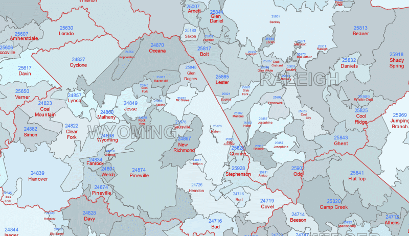
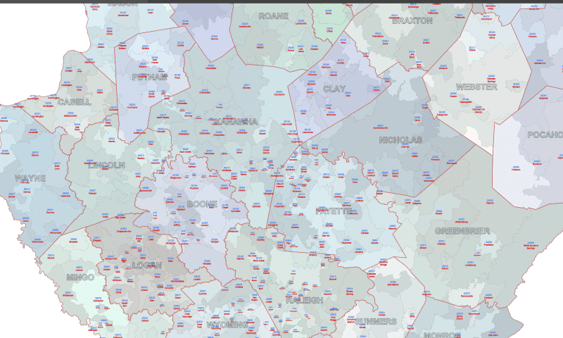
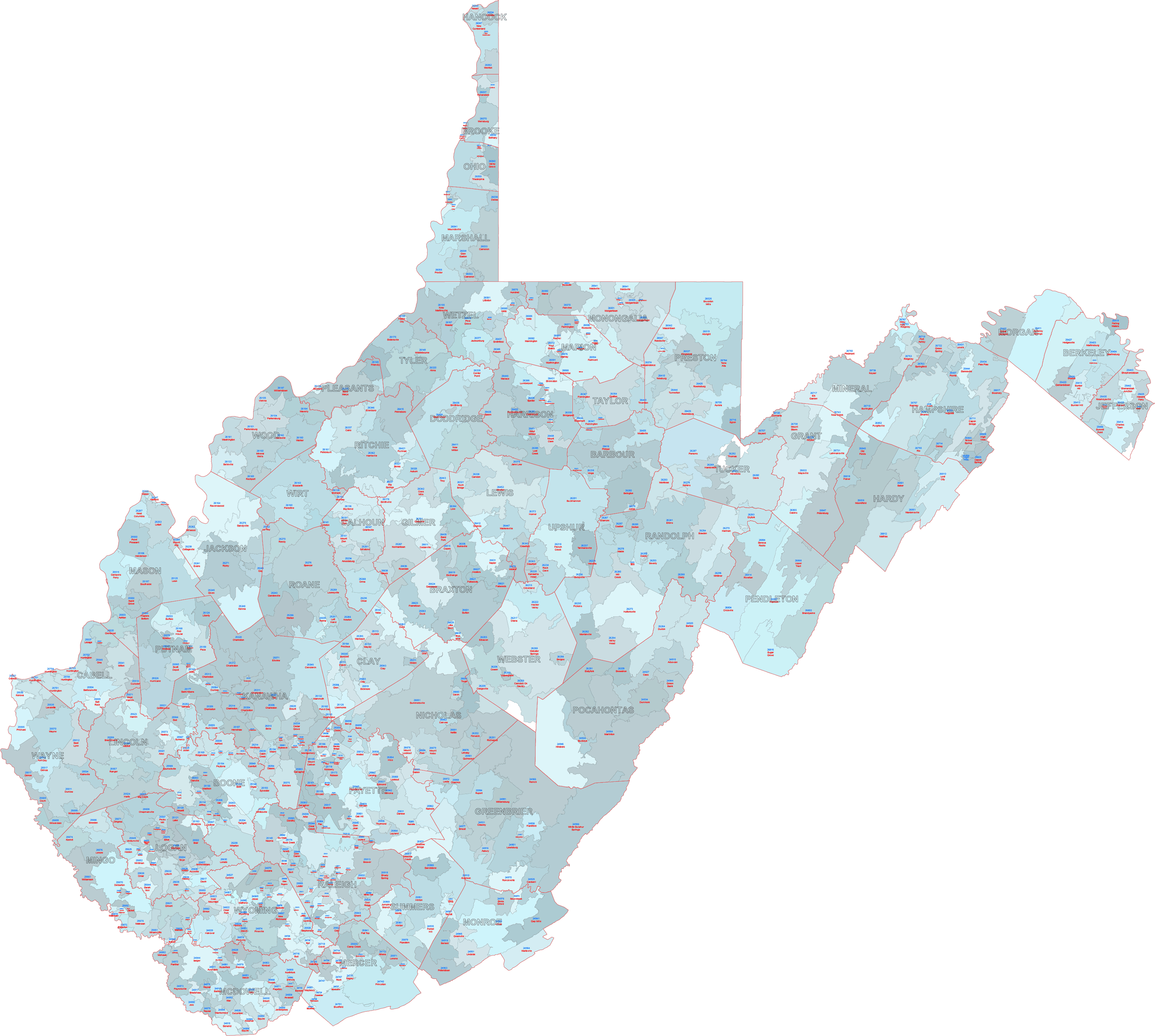
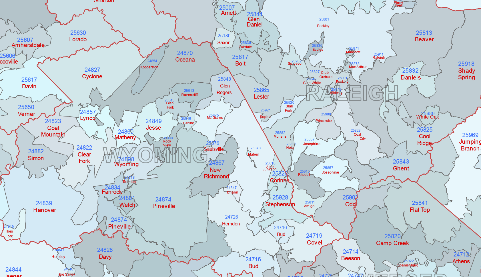
3. West Virginia State Zip Codes with Primary Cities & County Borders – Comprehensive Edition (You stay here)
- The most detailed map in the collection features uniquely colored 5-digit zip code areas with their corresponding numbers and primary city names. This primary city data is a unique addition, derived from our specialized data integration process to ensure up-to-date accuracy where the US Census data falls short.
- Overlays accurate county borders, clearly distinguishing each of West Virginia’s counties.
- Includes labeled county names on a separate, dedicated layer for easy identification and customization.
- Provides a rich geographic context, ideal for in-depth analysis, regional planning, and applications requiring both zip code and county-level information.
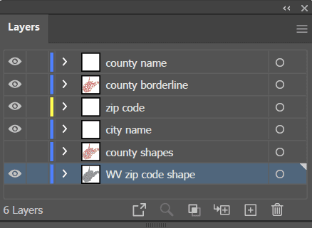
- Organized into logical layers within both Adobe Illustrator (AI, 2022) and Layered PDF files, allowing for easy manipulation and selective visibility of map elements (zip codes, city names, county borders, county names).
Unique Insights WV ZIP Codes With Cities Counties, Zip Code Ranges in Major West Virginia Regions
Gain a deeper understanding of the Mountain State’s key urban centers and surrounding areas with examples of their primary zip code ranges (note: these are general ranges and may include smaller adjacent towns):
- Charleston Metropolitan Area: Explore the state capital and largest city, generally encompassing zip codes like 25301-25396 (Charleston) and extending into surrounding communities like South Charleston (e.g., 25303, 25309).
- Morgantown Metropolitan Area: Discover this northern West Virginia hub, typically covered by zip codes in the 26501-26508 range, including Morgantown itself and surrounding areas.
- Huntington-Ashland-Ironton Metropolitan Area: Focus on this tristate metropolitan area, with West Virginia components generally in the 25701-25707 range (Huntington).
- Parkersburg-Marietta-Vienna Metropolitan Area: Investigate this Ohio River Valley area, with West Virginia components typically associated with zip codes like 26101-26106 (Parkersburg).
Only logged in customers who have purchased this product may leave a review.


Reviews
There are no reviews yet.