Guard your time. It's all you have. Naval Ravikant


Related Products
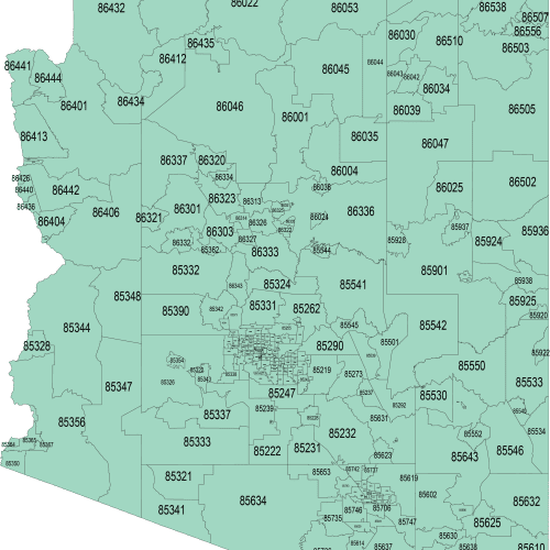
Arizona Zip Code map
Price range: 12,00 $ through 15,00 $
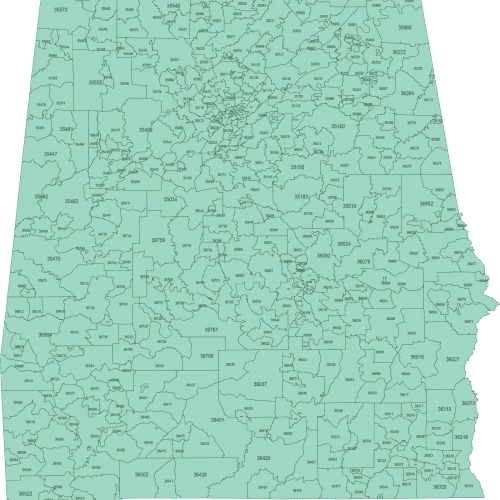
Alabama ZIP Code Map Basic
Price range: 12,00 $ through 15,00 $

24,90 $ – 29,90 $Price range: 24,90 $ through 29,90 $
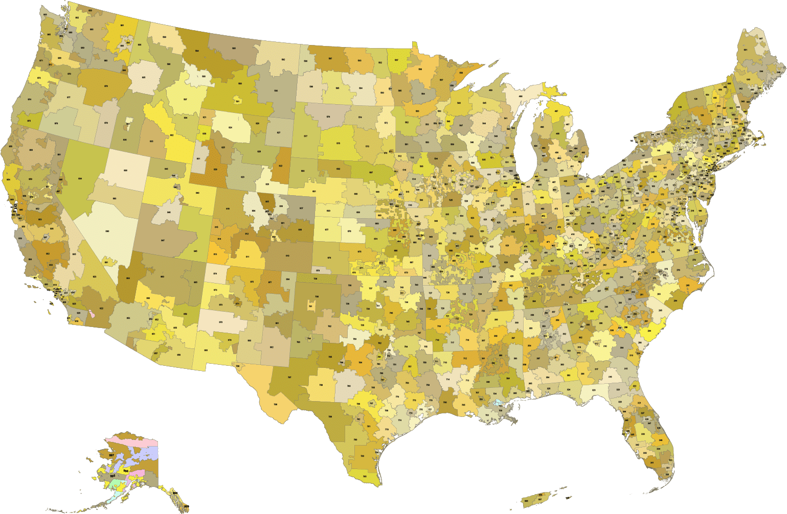
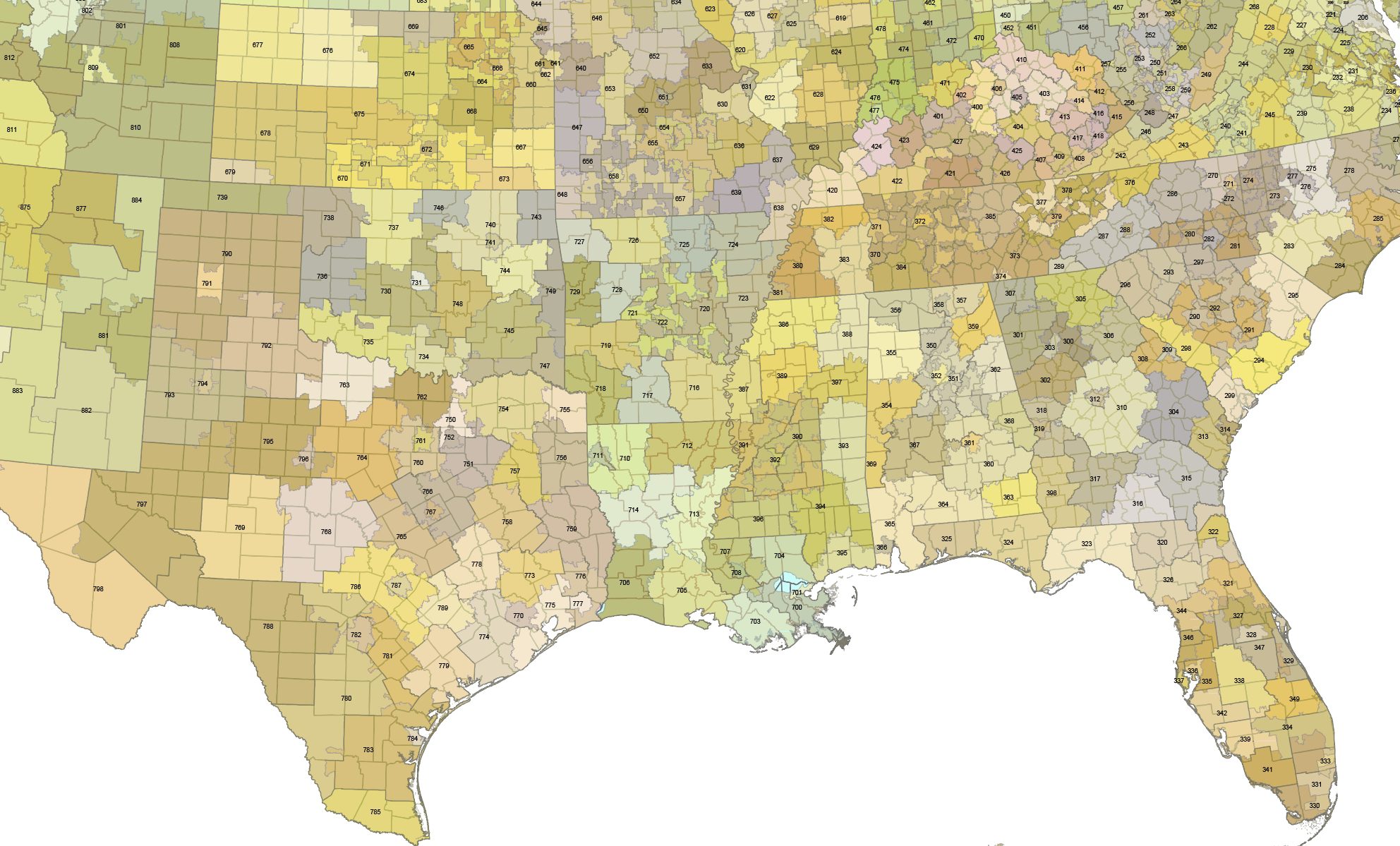
This high-quality USA 3-Digit ZIP Codes map with counties provides a clean, precise, and fully editable representation of ZIP code regions across the United States, including Alaska and Hawaii. Designed for professional cartography, GIS visualization, data analysis, and graphic design projects, the map features 3,144 U.S. counties displayed in the background for added geographic context. Albers projection.
Each ZIP code area and county is organized on separate, clearly structured layers, allowing easy customization, recoloring, and data integration. County names are not included as text, ensuring a clutter-free design and maximum flexibility for labeling or thematic mapping.
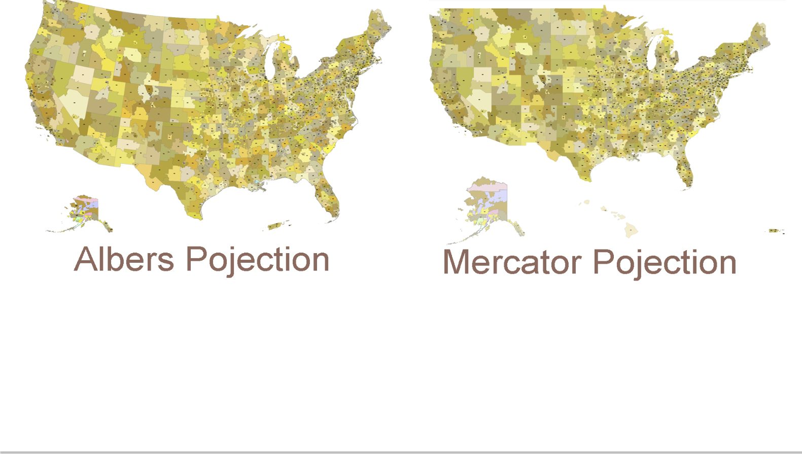
The map is available in two industry-standard projections:
Delivered in Adobe Illustrator (AI) and layered PDF formats, this vector map is ideal for print, web, presentations, dashboards, and infographics.
Key Features of the USA 3-digit ZIP Codes map with counties
Perfect for designers, cartographers, marketers, researchers, and data visualization professionals who need an accurate and flexible ZIP code map of the United States.
Only logged in customers who have purchased this product may leave a review.
Reviews
There are no reviews yet.