Description
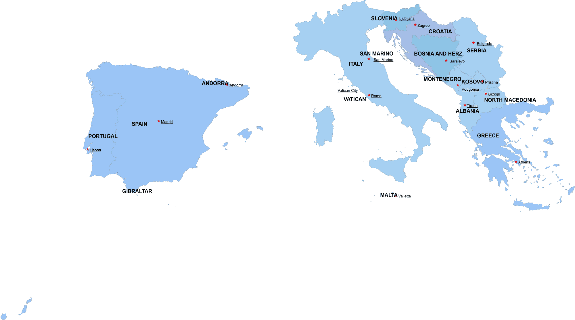
Southern-Europe digital map showcases the neighborhoods of 14 countries in an editable vector format. Each country is represented in varying shades of blue, while a star marks the capitals of these nations, along with their names. The map is created using the Web Mercator projection.
Iberian Peninsula
- Portugal – Lisbon
- Spain – Madrid
Italian Peninsula
- Italy – Rome
- San Marino – San Marino
- Vatican City – Vatican City
Balkans & Mediterranean
- Albania – Tirana
- Bosnia and Herzegovina – Sarajevo
- Croatia – Zagreb
- Greece – Athens
- Malta – Valletta
- Montenegro – Podgorica
- North Macedonia – Skopje
- Serbia – Belgrade
- Slovenia – Ljubljana
✅ #SouthernEuropeMap
✅ #DigitalMap
✅ #VectorMap
✅ #EditableMap
✅ #InstantDownload
✅ #AIFile
✅ #PDFFiles
✅ #SouthernCountries
✅ #MapDesign
✅ #GeographyMap
✅ #MapIllustration
✅ #EuropeCartography
Only logged in customers who have purchased this product may leave a review.


Reviews
There are no reviews yet.