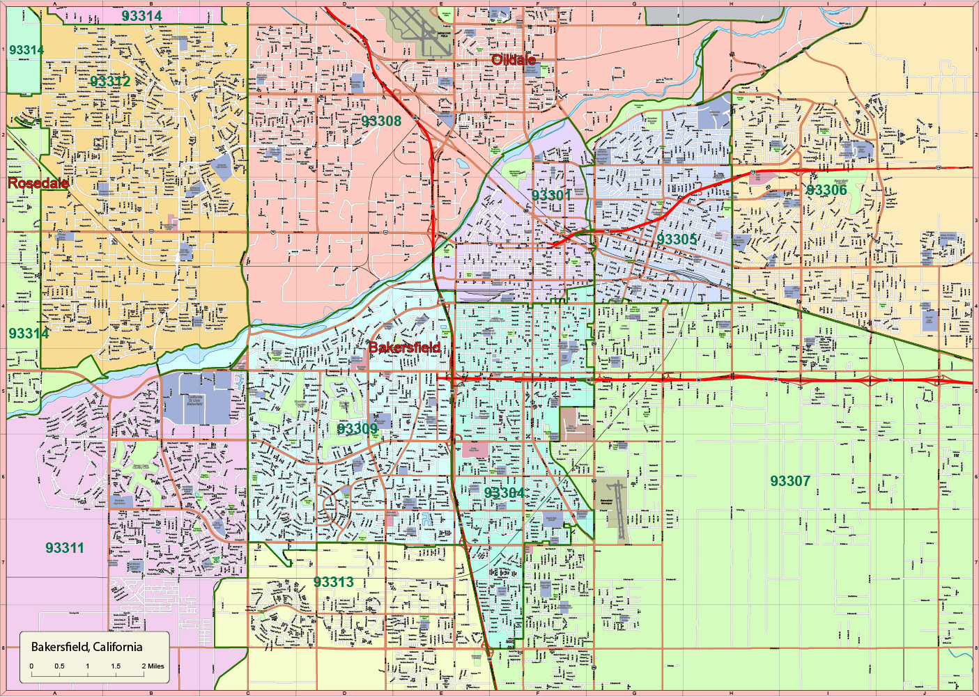
Description
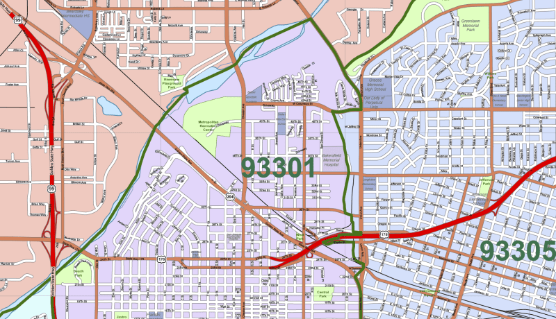
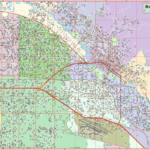
Bakersfield-CA Vector City Map – Editable Adobe Illustrator Format with Zip Codes, Landmarks & Local Streets
Navigate Bakersfield with precision using this detailed vector map, crafted for seamless editing in Adobe Illustrator 2022. Covering approximately 130 square miles, this scalable and layered map delivers accurate geographic and civic data, ideal for designers, developers, and planning professionals.
The map is structured into 17 fully editable layers, allowing you to quickly style, extract, or modify elements like road networks, zip code zones, parks, schools, water features, and landmark zones.
Map Features:
✅ 17 Custom Illustrator Layers Include:
- Route signs: highways, expressways, and state roads
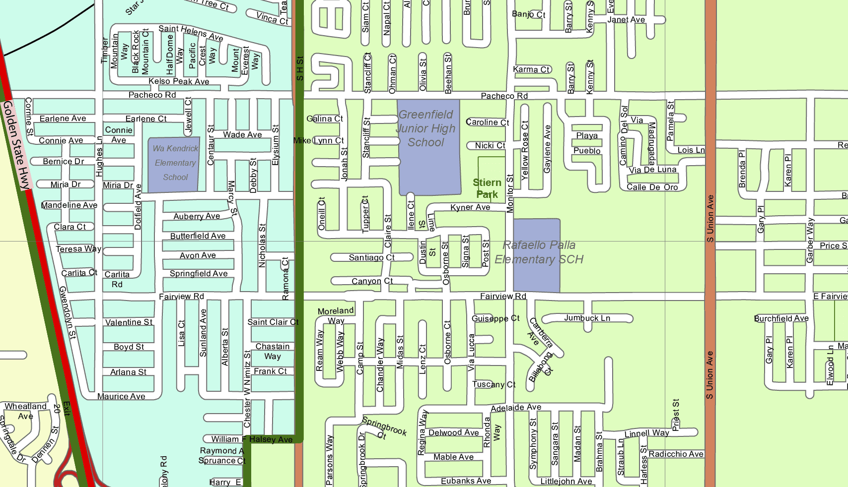
- Editable street grid (polyline format)
- City areas and neighborhoods (polygon and text)
- Waterways, parks, and zip code boundaries
- Educational, civic, and commercial landmarks
- Airports and transportation hubs
- Live-text zip code labels and city names
✅ Notable Landmarks Covered:
This map includes detailed vector zones and labels for:
- Bakersfield Municipal Airport
- Kern County Fairgrounds
- Kern Medical Center
- East Hills Mall, Valley Plaza Mall, White Lane Plaza, Rosedale Village Shopping Center, Chester Loop Center, Stockdale Town Center
- California State University, Bakersfield
- Seven Oaks Country Club, Stockdale Country Club, and more
✅ Technical Map Details:
- Format: Adobe Illustrator (.AI)
- Version: Illustrator 2022 and newer
- File Size: ~11 MB
- Fully scalable vectors with editable live text
- Clear layering structure for fast navigation and selection
Ideal For:
✔️ Urban and zoning planners
✔️ Real estate developers and marketers
✔️ Design agencies and educators
✔️ GIS mapping, reports, or signage projects
🔹 Meta Description (for SEO):
Download an editable vector map of Bakersfield, California in Adobe Illustrator format. Includes 17 layers with zip codes, CSU Bakersfield, malls, airports, and local landmarks.
HI-RES IMAGE OF MAP
Bakersfield vector city map. Zoom
Only logged in customers who have purchased this product may leave a review.


Reviews
There are no reviews yet.