Boise-ID City Vector Map
45,00 $
AI customizable styling, scalabilityPDF cross-platform compatibility
- Description
- Reviews (0)
Description
Boise-ID City Vector Map – Adobe Illustrator Format with Zip Code Zones, Neighborhoods & Landmarks
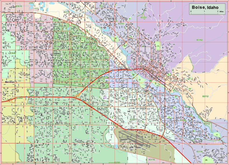
Navigate Boise with precision using this detailed vector map of Boise, Idaho, designed for Adobe Illustrator 2022. Spanning approximately 110 square miles, this fully editable and scalable map is perfect for planners, developers, designers, and anyone working on Boise-area presentations or zoning projects.
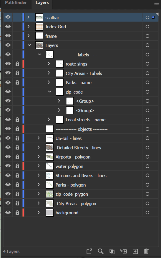
The map is meticulously organized into 17 customizable layers, allowing you to isolate and edit features like road networks, zip code regions, parks, civic zones, and public landmarks.
Map Features:
✅ 17 Organized Vector Layers Include:
- Route signs for highways and major roads
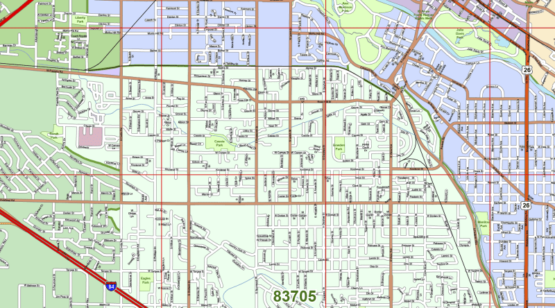
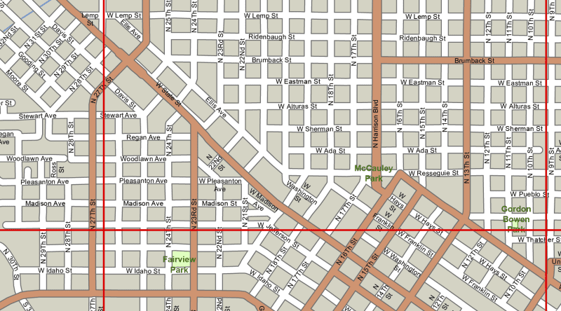
- Full street network (polylines)
- Water bodies, rivers, parks (polygons + text)
- Zip code areas with labeled zones
- City areas and neighborhoods with editable names
- Live-text labeling for zip codes and city names
✅ Neighborhoods & Areas Covered:
This map includes all major Boise neighborhoods and surrounding areas:
- Morris Hill, Depot Bench, South Boise Village, Sunrise Rim, Maple Grove–Franklin, Winstead Park, Garden City, Boise Hills Village, East End, Warm Springs Mesa, Barber Valley, Boise Airport
✅ Included Zip Codes:
- 83713, 83704, 83642, 83709, 83705, 83706, 83703, 83714
✅ Technical Map Details:
- Format: Adobe Illustrator (.AI)
- Illustrator Version: 2022+
- File Size: ~12 MB
- Scalable, vector-based design with editable live text
- Clearly grouped and color-coded layers for fast editing
Ideal For:
✔️ GIS and zoning teams
✔️ Urban planning and presentations
✔️ Real estate marketing and development
✔️ Graphic design and custom map projects
HI-RES IMAGE OF MAP
Only logged in customers who have purchased this product may leave a review.

Reviews
There are no reviews yet.