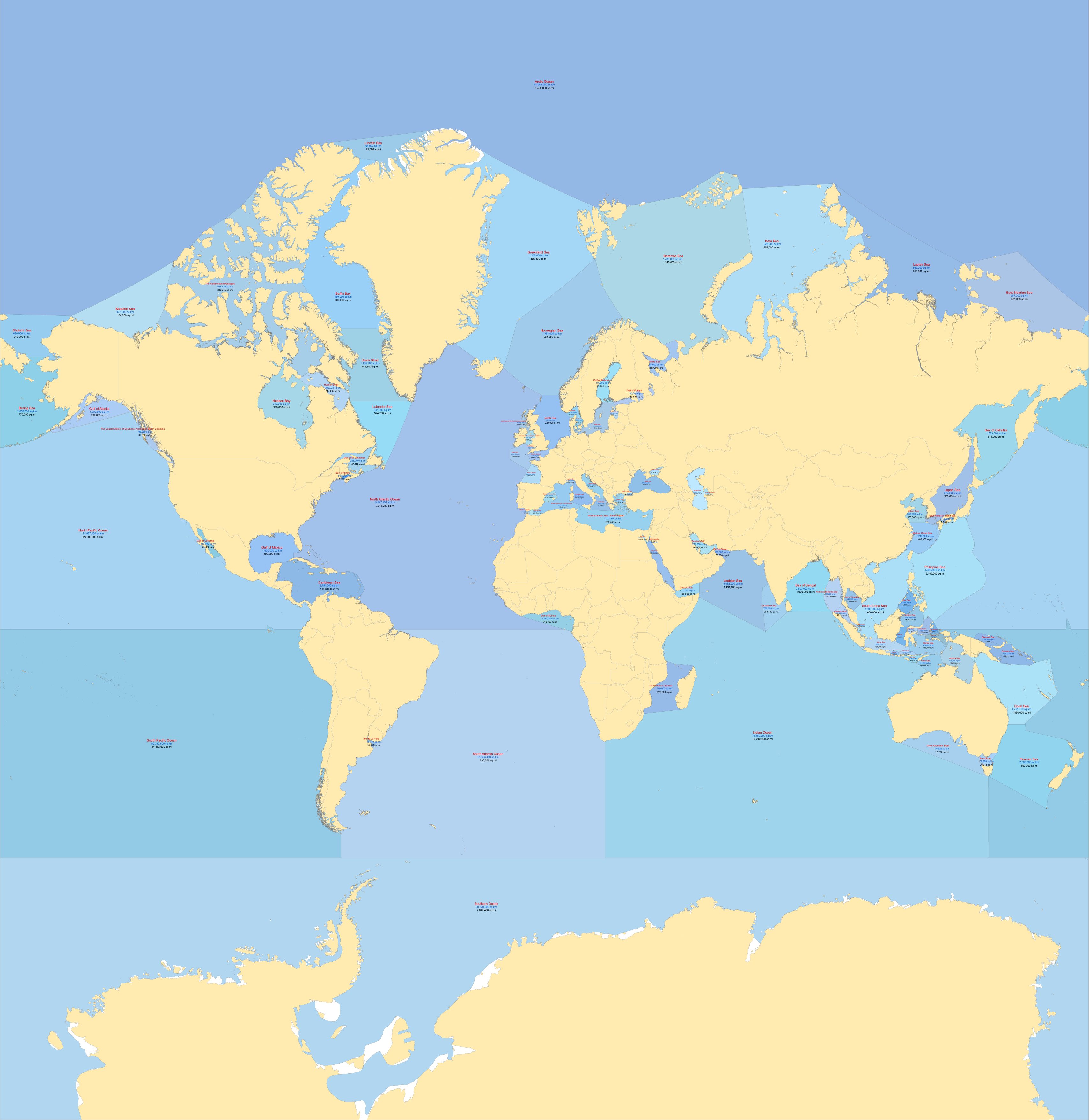
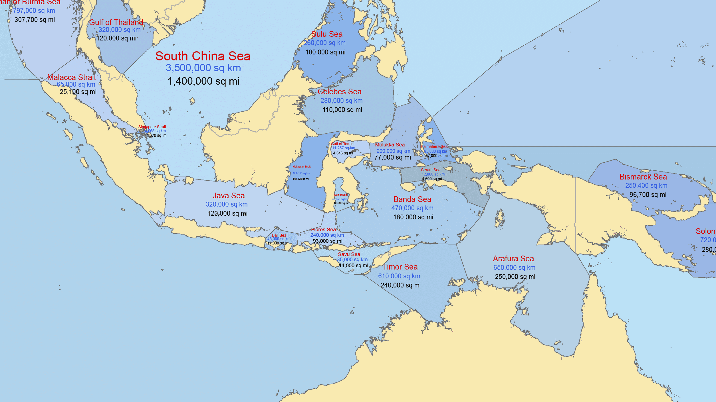
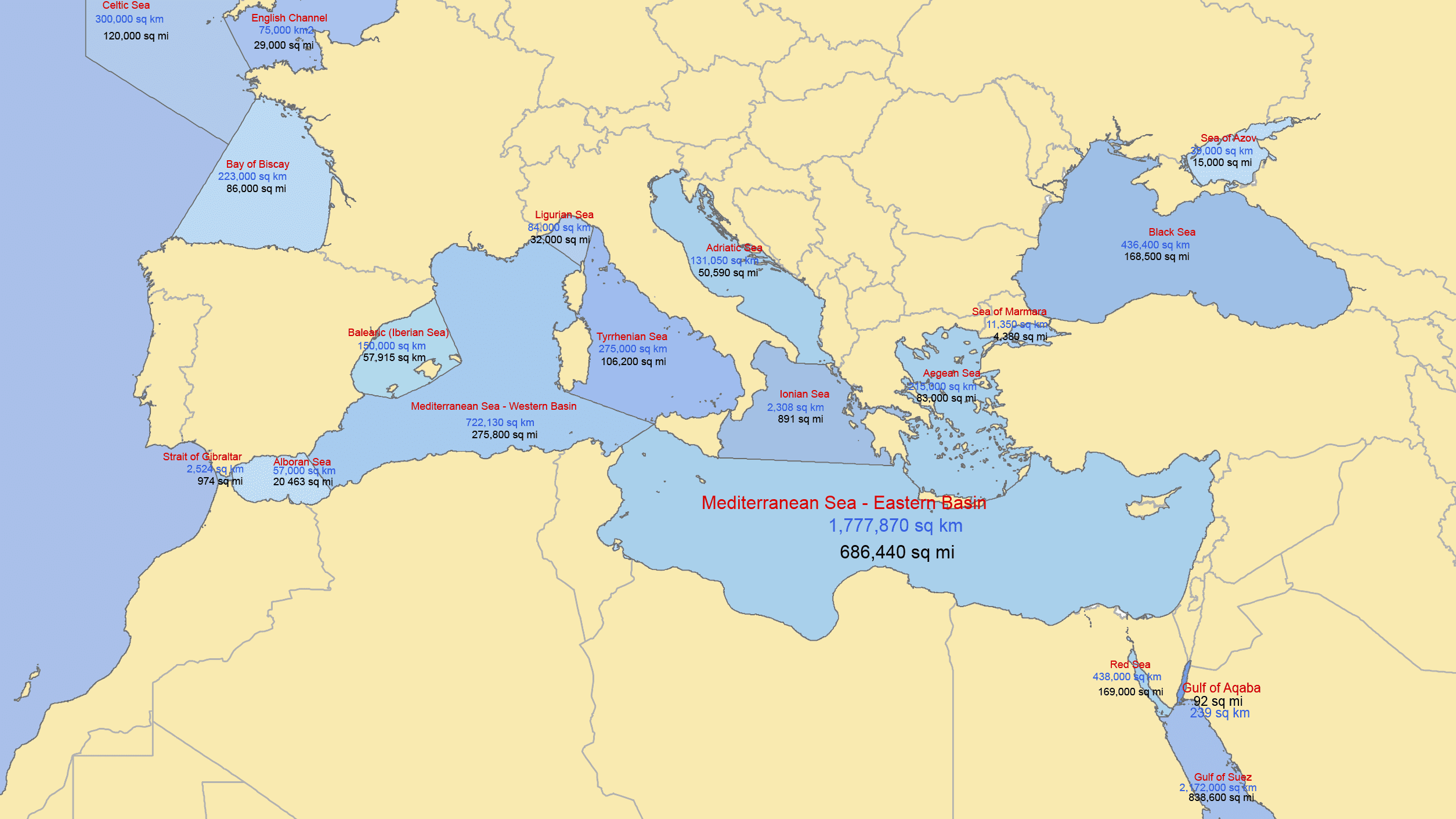
Description
Explore Seas and Oceans of the World the world’s waters with this detailed and beautifully organized vector map featuring 100 known seas, oceans, and major bays — all presented on a single, comprehensive map.
This professionally designed map highlights the full global network of marine regions, including all major oceans and prominent seas such as the Pacific Ocean, Atlantic Ocean, Indian Ocean, Arctic Ocean, Mediterranean Sea, Caribbean Sea, South China Sea, Bering Sea, and many more — carefully arranged for clarity and visual balance.
What’s Included
- 100 seas, oceans, and major bays clearly delineated
- Surface area provided for each body of water in both square miles and square kilometers
- All countries with accurate borders (no country names included — perfect for custom labeling or design projects)
- Clean, scalable vector format for professional use
File Formats
- Adobe Illustrator (.AI)
- Layered PDF (.PDF)
Both files are fully editable and organized for easy customization.
File Formats
• Adobe Illustrator (.AI)
• Layered PDF (.PDF)
Both files are fully editable and organized for easy customization.
Perfect For
• Educational materials
• Atlases and publications
• Infographics
• Wall art and prints
• Geographic and data visualization projects
This is a high-resolution, fully scalable vector map designed for designers, publishers, educators, and cartography enthusiasts.
Instant digital download — start working with the map immediately after purchase.
Only logged in customers who have purchased this product may leave a review.


Reviews
There are no reviews yet.