East South Central Region Map
0 out of 5
32,00 $ – 36,00 $Price range: 32,00 $ through 36,00 $
Category: USA
AI customizable styling, scalabilityPDF cross-platform compatibility
- Description
- Reviews (0)
Description
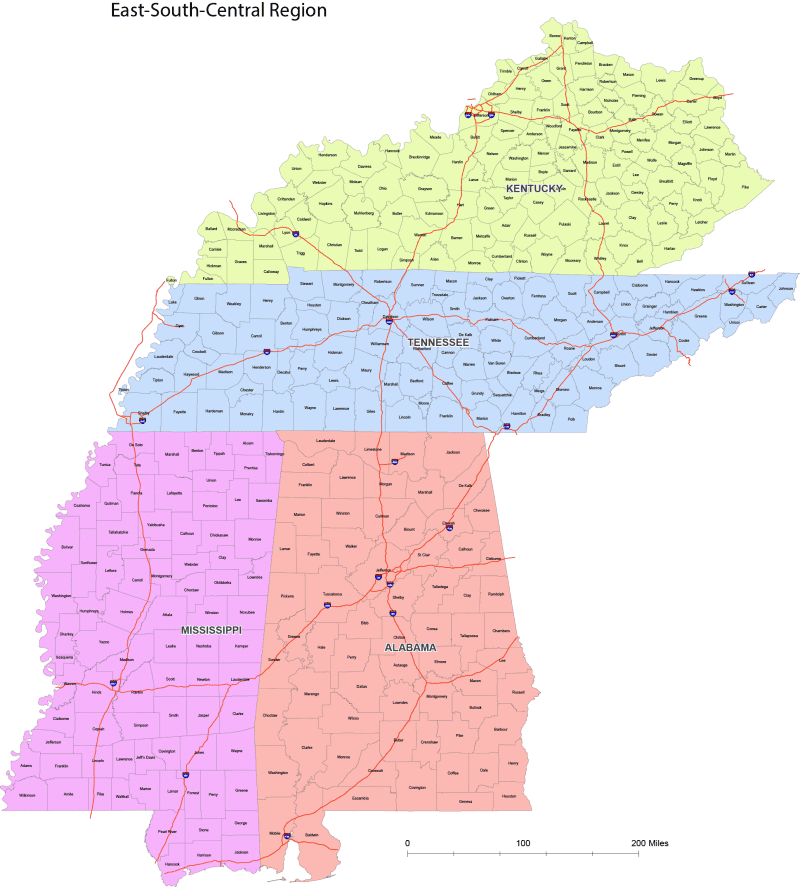
US Regions Map – East South Central Region Map (Vector File)
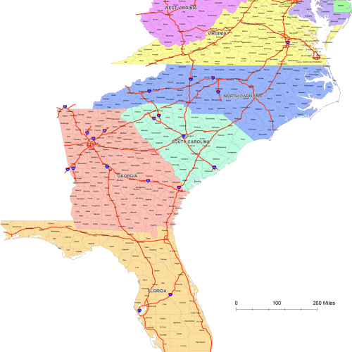
This high-quality vector map of the United States by region is designed using the East South Central County Map—perfect for accurate, proportional mapping of the U.S.
Kentucky, Tennessee, Wisconsin, Alabama
What’s Included:
- Adobe Illustrator (.AI) file – fully editable and layered
- Layered PDF – easy to open, print, or edit in most design software
Map Features:
- Colored by Region – Each region is color-coded for quick visual grouping
- State Shapes Grouped by States – Easily select, move, or edit regions as separate vector groups
- All county names – clean, legible labeling across all 5 states
- Web Mercator Projection –(as Google Map) A distortion-balanced projection ideal for regional U.S. data visualization
- Clean Layer Structure – Organized by regions, labels, and base map for easy editing
Perfect for:
- Data visualization projects
- Educational materials
- Infographics and posters
- Print or web design
- Business presentations with geographic components
Only logged in customers who have purchased this product may leave a review.
Related Products
USA
Internal US Map with Roads and Capitals
0 out of 5
17,90 $ – 19,90 $Price range: 17,90 $ through 19,90 $
USA
Detailed US Vector Map – Atlas Style
0 out of 5
23,90 $ – 24,90 $Price range: 23,90 $ through 24,90 $
USA
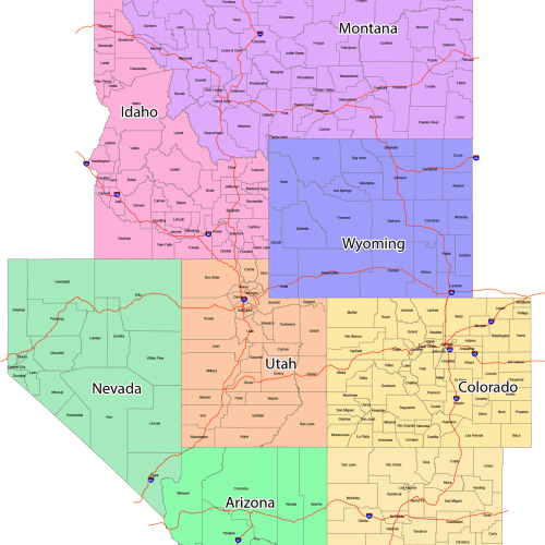
GeoPrime: Mountain Region County Map
0 out of 5
55,00 $ – 59,90 $Price range: 55,00 $ through 59,90 $

Reviews
There are no reviews yet.